-------------------------------------------------

Visible image this morning of Cat 4 Hurricane Matthew (above), which threatens Jamaica, Haiti, and eastern Cuba. Right now the NHC forecast indicates a nearly direct hit on the Guantanamo Military/Political prison - perhaps Matthew can shut it down?
-------------------------------------------------------

Parts of the area received showers yesterday afternoon - low top convection with no lightning or thunder. Above is 24-hour rainfall ending at 7:00 am MST this morning. Here at house we ended up with 0.12" in the gauge.
--------------------------------------------------------------

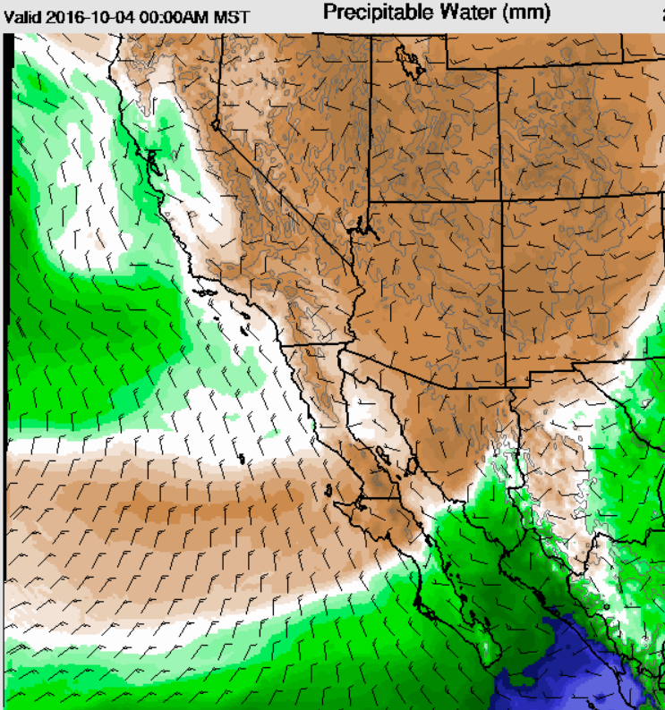
Morning sounding plot for TWC above indicates westerly flow through the troposphere, with PW of 0.86" and a sliver of CAPE. The blended PW analysis for 12 UTC from CIRA (below) shows a bit of moisture hanging on over southeast Arizona. The 06 UTC WRF-NAM forecast of PW (on 5.4 km grid - second below) is valid at midnight and indicates a serious dry-out during the day today.


From Mike Leuthold:

Photo above from the dark skies out in Paradise of the Witch Head Nebula in Orion. Below is motion camera shot of mountain lion passing through his property out there.

No comments:
Post a Comment