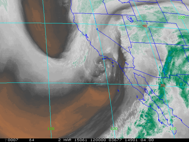
Water vapor image (above) from 12 UTC shows upper-level cyclone spinning west of San Diego this morning, as a trailing S/W digs southward toward it. The concurrent, blended PW analysis from CIRA at Colorado State (below) indicates that the AR that plowed across southern California and west to northern Arizona is now barely distinguishable, as a broad swath of tropical moisture is pulled northward - key question today is how much low-level moisture (mostly below 600 mb) will be pulled into southeastern Arizona before the event ends.


Radar echoes indicate most rainfall currently out along the Colorado River and extending into northern Arizona (above is Yuma composite radar display for 12 UTC this morning). Precipitation amounts exceed an inch at Kingman and the Grand Canyon (mostly snow so far), with Flagstaff reporting about 2 3/4" so far (mostly rain!). The 06Z WRF-NAM forecast from Atmo continues to weaken this event's impacts across southeastern Arizona - below is model's forecast of accumulated precipitation through the end of the main event (midnight tonight). However, yesterday's caution is still appropriate - model forecast soundings for metro Tucson during afternoon would support heavy, but not very deep, convective showers - so watch the radar a bit later today.

No comments:
Post a Comment