skip to main |
skip to sidebar
View of above, from yesterday morning, is of cirrus uncinus over the Catalinas.
The morning WRF forecasts still indicate gusty east winds developing here later this morning.
Above plot (from MesoWest at Univ. of Utah) shows the low temperatures here in Tucson this morning. As usual there is much variability across the region due to the terrain effects, with warm spots near Redington Pass and east end of Catalinas and coldest along the washes. The low here was 28 F; first freeze of Fall/Winter at house (versus 39 F on Mt. Lemmon and 40 F on Mt. Hopkins). Note that this is two weeks earlier than first freeze last Fall. (Edited - I looked back at 2017 and first freeze here at house was not until December 8th!)

Above shows Freeze Watches for this morning from NWS yesterday. For comparison, plot below (also from MesoWest) shows regional lows recorded this morning - generally pretty good comparison but airport at 32 F was bit colder than forecast. Note several readings in the teens, and the 13 F at the cold spot west of Tombstone. Problems apparent at the grasslands research area (north of Mt. Hopkins) where plot indicates -90 but color code seems to indicate low in 40s.
Extreme dryness continues with PW very low (plot below is time-series of GPS PW on campus). Dry and itchy eyes and skin probably affecting lots of people in area.
Above view shows steam fog this morning over the Snake River at Irwin, Idaho (east of Idaho Falls). At bottom is view of snowy Loveland, Colorado, yesterday afternoon (from son Jason's house).
Fair and dry weather continues here, with cold mornings and mild afternoons. The low here this morning was 36 F (coldest so far this Fall, after 37 F yesterday) - freezing or below tomorrow morning?
At 500 mb (above for 12 UTC) this morning a sharp, positively tilted trough extends southwestward from northwestern Minnesota across Arizona. Behind the trough surface temperatures are very cold (teens to -25 F and colder from the Front Range westward across the Great Basin. Surface high pressure over the Basin is producing continued strong east winds and high wildfire threats over southern California.
The morning sounding at TWC (above) indicates light winds at present below 700 mb, with a PW of 0.66 cm (slightly over a quarter of an inch). Below is the sounding from Flagstaff, where winds are very strong just behind the trough and PW is extremely low (.04 cm or .02 inches - values so low that accurate measurement is difficult).
The 10-m wind forecasts from the 12 UTC run of the WRF-RR. Above forecast is on the 5.4 km grid and is valid at 9:00 am MST this morning; while below is on the 1.8 km grid valid at 10:00 am tomorrow. Note the strong east winds over southern Arizona as front from southern Plains backdoors across our region.
Cooler and dry tomorrow - the last rain here at house was back on September 26th, and it looks like our dry spell will continue on well into November.
View of Tetons from Jackson Hole this morning - note the large bird nearly in center of image. Down at bottom is view from the other side at Star Valley Ranch.
Tucson metro area winds with gusts above (from MesoWest). Plot shows large variability with strongest gusts west of Redington Pass and to the south. Estimated winds here this morning of 30 to 40 mph. Kitt Peak and Mt. Hopkins winds have gusted to around 50 mph.
Plumes for wind speeds above (from 06 UTC GEFS forecasts) indicate another windy period on Sunday the 27th. Plumes for PW (below) continue with low values, although a small bump comes in from east on Sunday. Continues to look like October will close out with no precipitation for the month.
Neighbors John and Jodi Ferner brought us a bag of coffee from Flagstaff - it's very good and smooth. But I post photo because of the "Storm Chaser" blend - although, art is obviously down in our part of Arizona.
Rainbow on Tuesday hangs over the Capital. It's bringing luck for the Nationals in the World series, but I won't elaborate on the political messes ongoing under the bow.
High winds and wildfires happening again in northern California - above image from last night in Sonoma County's wine country.
The 500 mb analysis for 12 UTC this morning (above) shows sharp trough from our area north to Nebraska Panhandle. The California winds were occurring as pressures and heights rose markedly over Nevada behind this trough. Much of the West remains very dry, with low PWs - MIMIC analysis of TPW below was from 6:00 am MST this morning.
The precipitation outlook remains grim - forecast above (from 06 UTC WRF-GFS run at Atmo) is for total precipitation through noon next Monday. However, the cold front associated with the 500 mb trough will backdoor across southeastern Arizona tonight, and bring strong easterly winds into our area. The 10-m wind forecast below (from same model run) indicates winds at airport over 30 mph at 7:00 am tomorrow morning. No hope yet for rain, but nasty winds if the WRF forecast verifies.
View from Atmo (camera is actually up on the Gould-Simpson building next to Atmo) this morning at 5:48 am MST, as sunrise nears.
Image above shows detected CG flashes for 12-hours ending at 5:15 am MST. Thunderstorm activity only occurring far to the southeast of Arizona and northwestern Mexico.
Above is a 14 day plot of PW on campus. General trend has been drying, with a couple of bumps up to around an inch from 15th to 19th. Values now at a very low quarter of an inch.
Precipitation outlook remains dismal, and I'll have to keep watering some of the outside plants this week. Forecast below of total precipitation (from 00 UTC WRF-GFS on 5.4 km grid) needs no commentary - ugh.
Another cloudless morning here in Tucson. Below is view from Mt. Lemmon sky cam at a little after 6:00 am MST. In center of image is the waning moon, nearly overhead.
Second below is time series for conditions at the airport during past two days. Saturday and Sunday were quite similar, with a bit of drying yesterday.
Biggest weather news yesterday was an October severe thunderstorm outbreak from Southern plains to the Mississippi. There were two tornadoes with the storms, and two produced tornadoes. Image below shows a tornado moving across parts of the Dallas metro area after dark. This storm produced significant damage along its path.
Heavy, low clouds on the Catalinas this morning, but little threat of any rain. Satellite image below, from a bit after 7:00 am MST, shows low clouds over much of southeastern Arizona. Perhaps some light showers up in White Mountains?
Our warmer than normal and very dry weather continues here in Tucson.
Outlook for rest of month continues grim. The forecast above (from 06 UTC GFS run) is valid way out at 06 UTC on November 1st - closest rainfall/snow forecast is up over northern Colorado and along Continental Divide down in Mexico. So model forecasts indicate that October will end up here having had no precipitation. There have been three other Octobers since 1999 with no precipitation here at the house.
Photograph below shows that Yosemite Falls isn't, as it also awaits some rain or snow to produce a flow again.
Photo above, from hot air balloon, is of Flat Creek, northeast of Jackson Hole, Wyoming (I think).
Image above is the radar forecast from the 18 UTC run (yesterday and valid at 5:00 pm yesterday) of the WRF-GFS at Atmo - totally suppressed. Plot of detected CG flashes (below) is for 12-hours ending at midnight last night. Indeed, Arizona and most of Sonora were totally void of any storm activity as per model forecast.
Since we are halfway through October, an important question is: will there be any rain at all this month here in Tucson? Too soon to tell, but the forecast at bottom (from the 06 UTC WRF-GFS forecast today) is valid at 06 UTC on October 25th and looks grim.
Above image seems to me to be from Mauna Kea looking southwest (map of Big Island below). I may not have the orientations correct - any help appreciated! The image captures city lights along the coast, with constellation Orion hanging above.
Snow along Colorado Front Range yesterday was generally in 2 to 3 inch range - son in Loveland reported a couple of inches. Some higher elevations (as per above - exact location unknown) had about half a foot.
Here in southeastern Arizona there is not much weather to talk about. Continued mild and dry for at least next five days - as per morning forecast (below) from NWS.
Forecast highs range only from 86 to 89 F, with lows of 54 to 58 F at the airport. Here at house the low this morning was 48 F - first morning of Fall with a low into the 40s.
Any weather for us will rely on how things evolve re tropical storms in the east Pacific - see morning outlook from NHC at bottom.
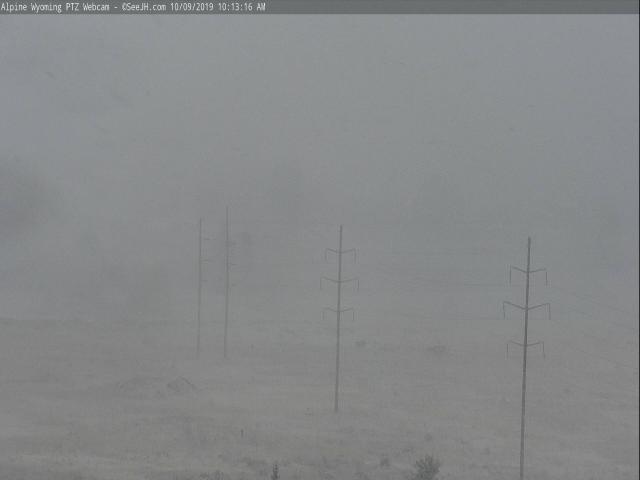
Continues mild and dry here - PW this morning less than a cm - but an October storm to our north has brought snow and cold to a larger part of the West. View above of Boulder Creek earlier this morning. Down at bottom is ghostly line of poles near Alpine, Wyoming, yesterday morning.
A large, cold trough at 500 mb (above) covers the West at 12 UTC this morning. Concurrent satellite image (below) shows cloud cover over most of U.S. west of the Mississippi, except for our part of the Southwest. Surface plot for about 10:00 am MST (second below) shows that the cold front has pushed into northeastern New Mexico. This front will back-door into southeastern Arizona tomorrow, bringing easterly winds, but not much change in our mild temperatures.