Wednesday, August 31, 2011

Bit More Storm Activity


Have been having internet problems here at the house this morning - so managed only a quick look at data and forecasts this morning.
-------------------------------------------------------
There were heavy clouds and some very light showers around this morning. Four ALERT stations picked up very light rainfall during the early morning hours. Yesterday afternoon Douglas was hit by a heavy storm that brought 0.69" in less than an hour and gusts to 41 mph.


The Tucson sounding this morning (above) has picked up a bit of PW (see the GPS time series below). The increases have not been at low levels and 850 mb dewpoints across southern Arizona are at their lowest values in many weeks. Looks like at most a sliver of low-elevation CAPE this afternoon. The forecast vertical wind profile for midafternoon has southerly steering flow and light or westerly winds at anvil level. So not a very good situation for low elevations. Some high elevation storms may produce sprinkles and dust and high winds as they try to come into lower elevations - note that storm bases will be at 600 mb or higher!


The Atmo early WRF-GFS run picked up the early showers nicely. The model forecasts an up turn in storm activity today across eastern Pima County. However, the forecast of rainfall through midnight (above) shows little in the way of rain on the ground, except at a few high elevation spots. So August will likely go out with heat, dust, wind, lightning, and rainfall at a few lucky places.

Tuesday, August 30, 2011

Isolated Thunderstorms Yesterday In Cochise County


Visible satellite image from 4:45 pm MST yesterday afternoon shows storms over Cochise County. Some of the Cbs were visible from Tucson also. The heaviest storms occurred on the east side of the Huachuca Mountains - Carr RAWS had 0.68" and Ft. Huachuca had a heavy storm that dropped 0.55" in 15 minutes, along with a gust to 44 mph. The RH during this storm reached only 54%, if the data are reliable (which at times seems questionable for this station). The Rucker RAWS had 0.16" and that was all I could find.


Today PWs are around an inch to 1 1/4 inch across southern Arizona. Winds in the troposphere are again light, and winds above 700 mb have an ominous westerly component. Don't find much CAPE likely this afternoon either. So little to look forward to today except more 100+ heat. The image above is from early Atmo run of WRF-GFS - forecast is total rainfall through midnight tonight. So, model forecasts another mostly down day, as does the morning NWS NAM.

Monday, August 29, 2011

August Ending Very Hot And Dry


Much flooding, and other Irene issues, are main topic of weather talk as the new week starts. Here in Tucson the dirty, dust-laden skies persisted through the day yesterday - 5 pm MST image is above. The cumulus at the right is about as much activity as we saw yesterday.


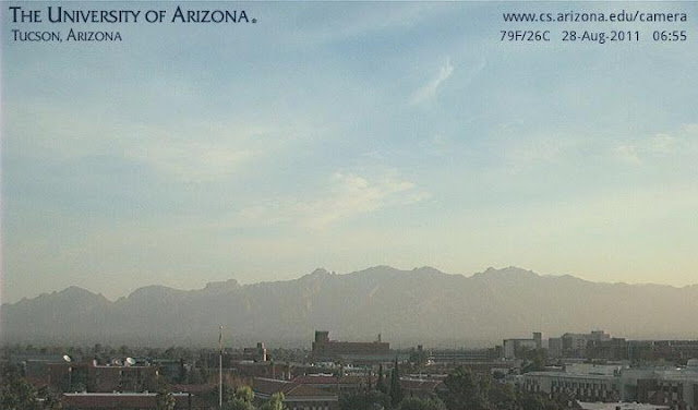
Today starts out with cleaner skies, as the current view of the Catalinas shows. Skies over most of  Arizona and northwestern Mexico are also very clear this morning (visible satellite image from 1430 UTC is below). Morning model runs hint at very isolated thunderstorms over higher elevations of southeast Arizona this afternoon - so that would be an uptick in activity. The middle and upper-level anticyclone is forecast to be nearly overhead at 0000 UTC this afternoon, and PWs are around an inch. Perhaps a bit of CAPE this afternoon as patches of higher moisture slosh around, and temperatures head into the 100s.


In the longer term, models hint at tropical activity in GoM and east Pacific later in the week - so all hope is not lost.

Sunday, August 28, 2011

WRF-GFS Spot-On Today


As per post this morning - the Univ. of Arizona runs of the WRF-GFS model forecast an absolutely down day today with no thunderstorms across southern Arizona. Models have verified spot-on this afternoon. Above two images are: (top) visible image at 4 pm MST showing no deep convection  over southern Arizona and Sonora - making this the most suppressed afternoon I can remember in weeks, and (bottom) southern Arizona at 5 pm MST.


The NWS has started posting a feature called today's weather story up at the top of their web page - probably at the behest of high-level D.C. dictators. Above is today's weather story, still live and online at 6:30 pm this evening. Obviously a tale of fiction today. Forecast was changed early this afternoon - so, my pitch would be that the bad story should have vanished also.
-----------------------------------------------------
Re - Comment on "Dryer" air - whoops, I missed that.

Tucson Sounding 0000 UTC 28 August 2011


I was checking on GPS PW this afternoon (see time series above - WRF-GFS had forecast PW to drop dramatically this afternoon) and noted that the situation was strange at 0000 UTC yesterday afternoon. The afternoon sounding was much wetter than the GPS data were - the opposite of the usual summer scenario with the RRS soundings. So, I checked to see what the sounding looked like (Univ. of Wyoming skew-T plot below). Looks like the bad sounding was taken in/near the thunderstorms that developed near the airpport yesterday afternoon - note the severe super-adiabatic layer above the apparent updraft layer. So it goes. Note that we're back to "normal" this evening.

Widespread Dust Hanging Over Southern Arizona


Yesterday thunderstorms from the west metro area out to the Colorado River Basin kicked up many clouds of sand and dust. With sunrise, even Tucson is covered by dirty skies and suspended dust (see above view of the Catalinas from campus this morning). The morning WRF-NAM forecast yesterday proved better than the early WRF-GFS, since it started storms around the Tucson metro, further east than did the other model, and then ran them toward the Colorado River. Yuma had a serious dust storm before midnight with gusts to 58 mph and there were two other wind damage reports between Tucson and Yuma - very desolate country, so it must have been quite ugly out that way. I also saw two wind reports from the southern California mountains - moisture is wrapped up around the back of the middle-level anticyclone across southern California and the Great Basin. The regional radar chart from 0300 UTC last evening (below) shows the area of storms between Tucson and Yuma. This morning there is a very large MCV spinning over western Arizona and it will head north today.


No rain or thunder or wind here at house yesterday - just another very hot and dry day. The eastern Pima County Alert network had 14 gauges with rainfall at 5:30 pm yesterday - about 15% areal coverage mostly in south and west portions of the network. A couple of large cells developed over the airport and moved west across the Tucson Mountains. The gauge out at Brawley Wash and Highway 86 had a local downpour that produced 0.71", which appears to have been far and away the most caught by any of the gauges. After 5:30 pm MST there was no rainfall recorded anywhere in eastern Pima County.


This morning's Tucson sounding is shown above. It is hanging on to a bit more than 1.25" of PW, although the data are a bit too moist wrt GPS PW. The sounding indicates CAPE and has a very good wind profile for organized storms again today. However, the early Atmo run of the WRF-GFS has produced a forecast for a totally down day across southeastern Arizona (the morning WRF-NAM forecast yesterday also indicated the same thing  for this afternoon). So, the WRF forecasts bring in serious drying from the east today - the early run today actually forecasts PW here at Tucson to drop below 20 mm this afternoon. It is very dry off to the east and southeast, and all the models (including this morning's NAM) indicate that drying during the day will shut down even the isolated storms we've been experiencing. Not a good forecast.

Saturday, August 27, 2011

Hot With Outflows Sloshing Around

Yesterday was mostly hot (TUS high 108F) and dry, but some isolated showers and thundershowers got going late, after a moist outflow from the west pushed back across Tucson. At 5:30 pm none of the 93 ALERT sites had any recorded rainfall. However, this morning's data show that 8 sites had measured very light amounts during the evening hours - areal coverage of a bit less than 10%.


The above webcam view of the Catalinas at 6 pm MST yesterday shows a very light shower on the right side of image. This shower was just to the north of the house - we had not a drop here and no thunder or lightning.


The time series of T and Td from Atmo is above - note the outflow around 5 pm that kicked the dewpoint up from middle 40s to upper 50s, and then a second outflow around 8:30 pm pushed it into the low 60s. Activity yesterday was mostly as predicted by the models, with most significant storms to the west and northwest.


This morning's sounding (above from Univ. of Wyoming) shows a shallow, cool layer near the surface and a deep, old BL above. There will be a bit of CAPE again this afternoon. Any convection will be very high-based with potential for producing gusty winds. The deep easterlies will dry things out again, but there may be more outflows sloshing around.


The early WRF-GFS (and NAM) again forecast significant storms to occur out to west and northwest (above is 7 pm WRF-GFS composite radar), where the moist and drier air butt heads this afternoon. The WRF-GFS doesn't let moist low-level air push in across metro area from the west until 8 pm or so. So, mostly another hot and dry day over southeast Arizona as August winds down.

Interesting Water Vapor Image


Above is a water vapor satellite image from 1000 UTC 27 August 2011. Two weather features dominate the continent this early morning - Hurricane Irene brushing the coast of North Carolina and a very large MCS over northwestern Mexico. The Guaymas morning sounding yesterday was extremely unstable with CAPE values of 4000 to 5000 J/kg. Very dry upper-tropospheric air covers the continent between these two features.

Friday, August 26, 2011

Another Marginal Day For Storms

Yesterday was indeed a bit of a zig-zag day for the models, with storm activity way down from Wednesday. Here at the house we were looking at mostly anvil cloud, although a couple of storms tried to go up beneath the high cloud. We had thunder and several sprinkles of rain, so another Trace day. None of the NWS sites or RAWS sites in southeast Arizona had measurable rain. Only 16 ALERT stations had rain (about 15%, down from nearly 40% the day before), and all but one site had less than 0.15".


The morning Tucson sounding plot from Univ. of Wyoming is shown above. There are winds stronger than 10 kts below 300 mb but the shear profile is not very good. Note that afternoon cloud bases would be up around 600 mb and winds above cloud base will tend toward uni-directional from the east at about 20 kts - this according to the early run of the Atmo WRF-GFS. There is only a sliver of CAPE indicated and low-level winds are also from the east.


The WRF-GFS surface forecast for 3 pm this afternoon is shown above. Note that surface winds remain easterly and dewpoints are down around 50F. So, mostly hot and dry today.


Finally, I'll show theWRF-GFS forecast of composite radar reflectivity valid at 3 pm this afternoon. This is as active as it gets in the forecast, with only some light thundershowers out west in central Pima County. Note that any storms that do develop will have the potential to produce downbursts, because of the high cloud bases.
-------------------------------------------------------------------

PS - All weather attention this weekend will of course be upon Hurricane Irene.

Thursday, August 25, 2011

Radiosonde Ascent Rates

The NWS RRS sounding systems allow detailed computations of the balloon ascent rate. Bill Blackmore has noted that significant oscillations in balloon ascent rate are often observed near severe thunderstorms - usually in the stratosphere but sometimes in the troposphere. An example is shown below.


This plot is for a sounding taken at Springfield, Missouri, near the time of the tornado at Joplin. Bill and Ryan Kardell have produced a report on these findings: "Observations of Significant Variations in Radiosonde Ascent Rates Above 20 Km - A Preliminary Report." Bill would welcome comments concerning these data and the report. It can be found at:

http://www.ua.nws.noaa.gov/Documents/Radiosonde%20Ascent%20Rates.pdf

NOTE - This is a large PDF and will take awhile to download.

Quick Look 25 August 2011

First, the early WRF-GFS for yesterday (earlier post below) actually was quite good, except for under-forecasting the convection in the middle San Pedro Valley and extreme eastern Pima County.


The 1530 visible image (above) shows that there is still quite a bit of debris cloud lingering over south-central Arizona. A big issue will be how much heating we get this afternoon - the storms yesterday produced some low-level cooling, but not enough to really cut down temperatures unless the clouds persist well into afternoon.

The morning Tucson sounding (above) has no CAPE indicated - thus, for low elevation storms we'll need to recover some boundary layer (BL) moisture - note that at least shallow moisture returned up the GoC to Yuma yesterday. The Guaymas sounding this morning has PW of over 65 mm - more than double what's over Tucson. At least a decent steering flow has finally developed in the 600 to 400 mb layer, where winds are essentially easterly at from 15 to 20 kts. The 500 mb anticyclone is broken into two lobes this morning - one over western Arizona and one over southeastern Colorado, with a weak trough/shear zone between from north of Guaymas northward into the Four Corners region. These features are nearly vertically stacked in the upper-troposphere this morning - but the NAM model forecasts the anticyclone to consolidate along the Colorado/New Mexico border during the next day or so.


The early Atmo run of the WRF-GFS bascially forecasts a repeat of yesterday for the Tucson area. Forecast above is a surface plot valid at 5 pm this afternoon. The model forecasts storms and several strong outflows to move into the metro area between 4 and 5 pm MST.


The model also forecasts an increase in precipitation across southeastern Arizona this afternoon and evening wrt yesterday. It forecasts substantial storms again in the central San Pedro Valley this afternoon - a possible model zig-zag?
----------------------------------------------------
The early WRF-GFS run today also indicates a completely down day tomorrow, as it forecasts a substantial intrusion of dry, low-level air from the east. So, several interesting things to keep an eye on out here in the Southwest.

Review Of Yesterday


High-based storms spilled over the Rincons and into the Tucson metro area after 5:30 pm last evening. The storms produced considerable winds and dust, as well as light rains in the eastern portions of the Pima County ALERT network. There was rainfall measured at 36 of the 93 ALERT sites (almost 40% areal coverage); more than I expected. However, TUS, DMA, Atmo and here only got spits and sprinkles and a Trace. Two ALERT sites in the northeast Catalina foothills had just over half an inch. I saw that Douglas also had just over half an inch also. Wind gusts of 30 to 50 mph were common (Atmo roof 62 mph, Mt. Hopkins 55 mph, and Nogales 52 mph), and I estimate gusts of around 40 mph here at the house. The photo above taken looking northeast around 5:30 pm MST shows dust cloud coming down the Rillito wash.


Since skies in the west remained clear and most of the rain stayed east, large parts of the metro area were treated to a riot of rainbows. Above shot shows north end of a complete, double rainbow that was quite spectacular.


Finally, middle cloud and some sprinkles at sunrise this morning (Thursday August 25th) provided a vivid sunrise that went gradually from purple to red to orange to yellow. View above is from the Computer science webcam looking north to the Catalinas.

Wednesday, August 24, 2011

Storms Trying To Move Into Metro Area


The two images above (surface plot top and NWS radar below) are from right around 5 pm MST this afternoon. Strong thunderstorms are trying to build westward across the Rincons from the San Pedro Valley. The storms will likely weaken as they move into lower elevations, but the extremely hot surface temperatures and very low RH mean that there's the potential for very strong outflow winds and dust during the next couple of hours.

Early Morning Showers Along The Borderlands

This morning there were light showers in the distance, surroundig Tucson from east to south to west - this was much as forecast by yesterday's early run of the WRF-GFS model. Visible satellite image below is from 1330 UTC. Douglas carried a sunrise thunderstorm on their observations. Yesterday storms in southeast Arizona made it as far north as the Tucson airport at lower elevations. The high cloud bases and light rain amounts led to some dusty outflows - outflow and dust here at house around 6 pm, with lightning visible from east to south after dark. No rain here, and only 8 of the ALERT gauges (mostly in far southern parts of network) had rainfall. I do see that the Carr RAWS station reported 0.61" - by far the largest amount at any gauge.


There is an inverted trough moving westward across the central and lower GoC - as forecast by the models yesterday. At 1330 UTC (IR image above) there was a very large MCS over the southern GoC, with some areas of light showers to its north, all the way to Arizona. Will this trough and associated convection be significant enough to trigger a new surge of low-level moisture into Arizona? The models hint that it will and that increased low-level moisture will spread into southern Arizona by morning tomorrow.


The Tucson morning sounding (above from Univ. of Wyoming) has PW of only 34 mm (the early run of Atmo's WRF-GFS forecasts this to drop into upper 20s this afternoon), and there will likely just be a sliver of CAPE present this afternoon. The wind field remains very chopped up through the troposphere - the strongest wind speed in the entire sounding is only 18 kts at 190 mb. Storm activity may even be down a bit today, as per the WRF-GFS forecast of rainfall through midnight (below) indicates. The latest run of the NAM is quite similar. Perhaps things will be a bit better tomorrow?

Tuesday, August 23, 2011

Hot, Dry Air To The Northwest

There remain at best only slight changes to the large-scale pattern this morning. The 500 mb analysis (from NCAR for 1200 UTC 23 August) below shows the huge anticyclone that covers much of the U.S. and northern half of Mexico. Note that the height gradients are very weak, so that light winds continue over the Southwest and northern Mexico.


The morning Tucson sounding (above from Univ. of Wyoming) shows the weak winds below 450 mb. The BL is fairly dry (afternoon BL mixing ratio will probably be around 8g/kg), but the high temperatures actually lead to an increase in CAPE this afternoon. There was a slight uptick in storm activity at higher elevations yesterday - as evidenced by 7 ALERT sites reporting light rain. Skies here at house were covered with orphan anvils by evening. The Atmo early run of WRF-GFS forecast indicates increased activity this afternoon along the Borderlands, and particularly to the south and southwest of Tucson. Interestingly, the WRF forecast also brings a second round of storms into southeastern Arizona well after midnight tonight. There is much drier low-level air off to the northwest toward Phoenix, and the WRF forecast indicates that Pima County is a battle zone, with the dry air trying to wedge in across the Tucson metro area by evening (850 mb Td forecast below is valid at 7 pm this evening).


This morning's NAM forecast holds some hopes for improved winds in the middle-levels. The 500 mb forecast below is valid at 5 pm MST tomorrow afternoon. The inverted trough moving across the middle GoC, and a strengthening of the pressure gradient to north of it, leads to increased winds along the border. Will see what tomorrow brings. Off to the east, Hurricane Irene churns along on a course that will threaten much of the East Coast.

Monday, August 22, 2011

Little Change

Little to report today. There were isolated, higher elevation storms yesterday afternoon, much as forecast by the early Atmo run of the WRF-GFS. The model has nicely captured the slow dry down that has occurred. PW across southern Arizona this morning runs from around an inch in the west to near 1.4" in the southeast. There were no reports of measurable rainfall yesterday anywhere in all of southeast Arizona - at NWS, ALERT and RAWS sites - although 2 RAWS stations in the White Mountains of Greenlee County had light rainfall. Radar did indicate isolated thundershowers during the afternoon, especially to the south and east of Tucson and up in the White mountains. Anvil cloud spread across the late afternoon skies here in Tucson.


Today looks to be quite similar, with isolated mountain storms as the dry down continues to some degree. The Tucson 1200 UTC sounding today appears to have at most a sliver of CAPE at the top of this afternoon's BL. Winds continue very light below 400 mb, while the upper-troposphere continues to have
southerly winds of 20 to 25 kts.


Early run of the WRF-GFS indicates some rainfall through midnight tonight at favored storm locations.
----------------------------------------------------
As mentioned in an earlier post, most weather attention this week will be on Hurricane Irene and its impacts along the east coast. Here in the Southwest, the 500 mb anticyclone will linger over New Mexico and drift toward the Four Corners. Then during the latter part of week (partly in response to events in the East), the anticyclone will shift northwestward into the Great Basin. Thus, some hope that we'll eventually have some winds in the lower half of the troposphere before week's end.

Sunday, August 21, 2011

Another Day Of Isolated Storms

Yesterday was the second day in a row (after the very big rain day last Thursday) with very limited storm activity. There were some isolated mountain storms yesterday, but the afternoon skies were mostly filled with orphan anvils. Two ALERT stations in the Catalinas measured rain and that was it. The WRF-GFS early run from Atmo did quite well - bringing in drier air from the west and forecasting limited mountain convection.


Nocturnal convection in the Borderlands and eastern Sonora has left the skies filled with debgris cloud this morning (see 1315z visible image above). There may be an MCV spinning over Sonra (edited 10 am loop indicates no such MCV present); will have to wait for he sun to get higher to tell for certain.


The TUS sounding has a bit more moisture than the 1.2" of PW it had yesterday afternoon. However, ignore the optimist SPC CAPE, since it appears that the afternoon BL will have only a sliver of CAPE. Thus, with limited CPE and morning clouds, expect a third, mostly down day at lower elevations.


The early run of the WRF-GFS from Atmo (accumulated rainfall forecast through midnight tonight shown above) keeps activity in Mexico and along the Borderlands to the south. So, this afternoon we will probably have a lot of anvil cloud zipping up from the south (see upper-level winds in TUS sounding), but not much hope for rain. (Edited - 10 am look at 1200 UTC Atmo WRF runs shows even less convection forecast by new runs.)

Saturday, August 20, 2011

Irene

The operational members of the ECMWF and the GFS having been forecasting a tropical system to approach Florida during the second part of next week. The models spin the system into a hurricane and bring it to north side of Cuba. Below are the 144-hour forecasts of surface pressure (from the ECMWF) and of 850 mb (from the GFS) both valid at 1200 UTC on Friday the 26th.


A recon flight today found a tropical storm already present and it has been named Irene. The initial NHC forecast for Irene is shown above. There is a lot of land mass between the storm and the Florida Straits - so weather eyes will be turned to the east during the coming week to see just how this storm evolves.