Sunday, December 24, 2023

Event Sumaary


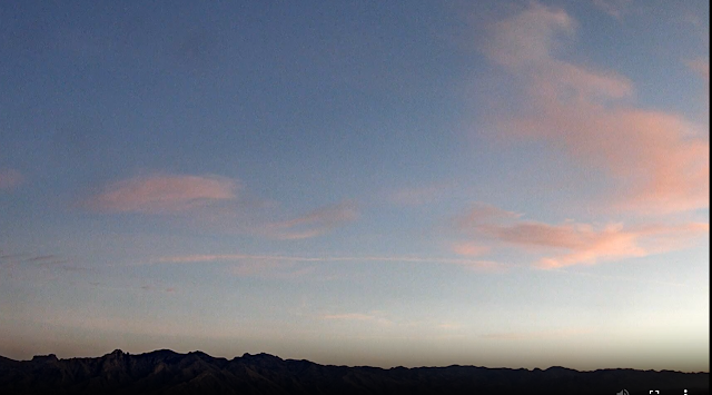
Clearing skies this morning at 7:35 am MST, following our widespread, significant rains.


ALERT network totals for the event (above and below). Amounts over 1 inch were common across most of the network.

Here at the house the final total ended up at 1:48" - this was heaviest two-day total since the 1.55" on January 15-17 of this year. ATMO reported 1.40"; DM had 1.31"; and the airport came in with 1.31".


The forecast run from the 06 UTC GFS (below) indicates we'll now have a dry end to 2023.

Friday, December 22, 2023

Event Update


View looking from campus toward Catalinas at 3:30 pm MST this afternoon, showing the widespread, light rain. The event started across much of the metro around 6:00 this morning and has produced significant amounts of rain.

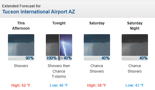
Current forecast for the airport (from the NWS Forecast Office - below) indicates gradually diminishing POPs through Saturday night.


Current base scan at 3:40 pm for the Tucson radar shows both the widespread nature of this event, and also the significant terrain blockage that impacts the radar's coverage and low-elevation scans. The IR image (below - also from 3:40 pm) shows the extent of the system that is moving through the Southwest,


Reports from the ALERT Network (below at 3:45pm) show widespread coverage of amounts greater than half an inch. Here at house there was 0.79" in the gauge at 3:00 pm, with light rain continuing. A most welcome event, after three weeks of dry conditions.


Thursday, December 21, 2023

Astronomical Winter

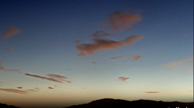
View toward the Rincons at 6:40 am MST this morning, with a couple of small, nearly stationary orographic clouds.

At 500 mb (above) there is a large, closed low centered west-southwest of San Francisco.

Morning forecasts from 12 UTC GFS (above valid at 12 UTC on Friday the 22nd and below valid at at 12 UTC on Saturday). The GFS forecasts indicate the closed low will come ashore near San Diego and move eastward across Arizona,


Current model forecasts (above from the 12 UTC run of the WRF-RR at Atmo) indicate that this will be a significant rain/snow event for much of southern Arizona. Morning NWS forecast for the airport (below) calls for very high POPs tonight through Saturday night.

So far our only December rain has been the 0.13" on the 1st.

Tuesday, December 12, 2023

Looking Ahead

Very dreary morning today with a heavy overcast. However, an IR satellite image (below - from 7:30 am MST) shows that the main cloud band should be moving by to the east in a bit.

The Winterhaven Festival of Lights (above) began Saturday and will continue through Christmas Day. Many years at least one cold and rainy event has occurred during the Festival. However, the long-range forecast of total precipitation (below - from the 06 UTC GFS run) indicates only a slight chance of light precipitation for most of Arizona. We'll wait to see what happens.

Tuesday, December 05, 2023

East Pacific Storms 2023


View looking toward the Rincons at 6:30 am MST this morning, showing some subtle pink colors. Shown at bottom is view of Catalinas at 7:05 am, with similar cloud colors.


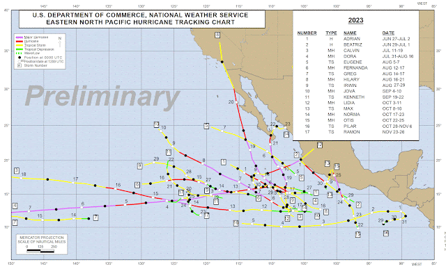
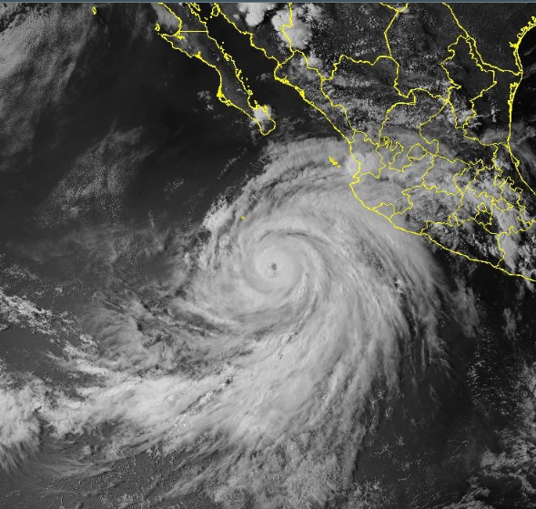
Chart above (from the NHC webpage - where the graphic is easier to view) shows Eastern Pacfic Tropical Storms and Hurricanes that have occurred so far this season. Hilary (shown below in visible image from 2240 UTC on 17 August) was the only storm that came north of 25 degrees north, moving into southern California far to our west. During its life Hilary reached Category 4 strength (130 to 156 mph maximum wind speeds). 

Thus, our summer was not very active this year, wrt to tropical events - which helps explain why this was second driest summer here since 1999, when my records begin.

Monday, December 04, 2023

Fall Summary 2023

View of light, morning showers on morning of September 12th. Bottom shows golden, early morning skies toward the Rincons on the morning of September 23rd.

During September we had rain here at house on only three days, with a total amount of 0.31".

During October we had rain on only one day that amounted to 0.69".

During November we had rain on five days, but amount added to only 0.48".

Thus, Fall rain total was 1.48", which is the 10th driest Fall since 1999. In my dailey log I don't mention that there were any thunderstorm days. However, the CG flash plots indicate that there was likely thunder here on four days that I did not hear.

I noted east winds of 35 to 40 mph on November 21st.

Saturday, December 02, 2023

Widespread Showers Yesterday


Skies are very clear this morning; view above looks north to the Catalinas at 7:30 am MST.


Coverage of precipitation across the ALERT network was essentially 100 percent for 24 hours ending at 8:00 am this morning (above and below). Amounts were light - generally a quarter of an inch or less. Here at house we had 0.13", as did Atmo, DM recorded 0.11", and the airport reported 0.20".


Plumes from the 06 UTC runs of the GEFS (above and below) indicate almost no precipitation at the airport through Saturday the 9th. Temperatures warm mid-week and then cool off again by next weekend. Graphic at bottom shows precipitation forecast from the 00 UTC WRF-GFS run at Atmo out through 5:00 am on Saturday December 9th - basically a mild and dry week ahead.

Friday, December 01, 2023

Showers Likely Today


Both sun and clouda at 8:30 am MST this morning - the first day of December.

There was only a bit of rainfall yesterday across the ALERT network (above), with another skiff of snow at high elevations.

At 500 mb (above) there is a broad trough over the Southwest, moving eastward.


Morning TWC/TUS sounding continues moist in low levels, with some CAPE, and strong west winds in the upper troposphere.


The 12 UTC run of the WRF-RR at Atmo forecasts some rainfall over parts of eastern Pima County today. Forecast above shows precipitation through midnight tonight. Current NWS morning forecast is shown below.