Friday, March 21, 2025

Astronomical Spring


The vernal equinox (i.e. start of astronomical spring) occurred yesterday during the early morning hours - diagram above.


Outlooks from the NWS Climate Prediction Center for April/May/June are shown here - temperature above and precipitation below. Looks like more of the same for the Southwest.

Tuesday, March 18, 2025

Tri-State Tornado


The Tri-State tornado occured 100 years ago. Its track strectched from Missouri, through Illinois, and into Indiana, and left nearly 700 people dead. It remains the dealiest tornado to this date.

Figure showing the track that was re-analyzed by Johns and others in second paper referenced below.


Monday, March 17, 2025

Saturday, March 15, 2025

Deadly Storm Outbreak

View of the Catalinas at 7:00 am MST this morning.

Light showers were scattered around the metro area during the night last night - we had 0.02" here at the house. See map of reports from MesoWest below.


There was a serious outbreak of severe storms yesterday - summary from the SPC (above) shows more more than 650 reports, with 27 tornadoes. Over a dozen fatalities have been reported.


This morning's 250 mb analysis (above) shows a powerful jet across the southwest that will be heading for the Southeast today. The SPC has issued a rare "High" probability area for more severe storms today - see below

Friday, March 14, 2025

March 14


More Showers


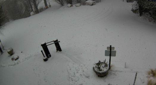
Some new snow at Summerhaven, as shown above at 8:50 am MST this morning.


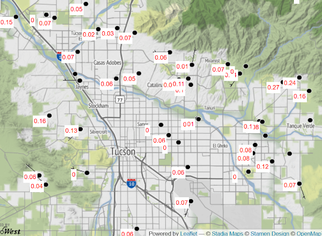
Rainfall coverage across the ALERT network (above and below) was almost 100% for amounts of 0.04" or more (above and below, for 24-hours ending at 8:45 am this morning). Rainfall here was 0.19", most of which fell before midnight last night. The airport reported 0.11", DM had 0.12", and Atmo had 0.17".. Winds were strong and gusty across most of the state, as per 46 mph at the airport, 56 mph at Winslow, and a gust to 74 mph at Guthrie over near the New Mexico border.


The NWS outlook for rainfall amounts from this evening through tomorrow morning is shown above, and the current forecast for the airport is shown below.

Wednesday, March 12, 2025

Nighttime Showers


Heavy clouds on the Catalinas at 6:45 am MST this morning.


The 500 mb low that was west of southern California/northern Baja yesterday opened up during the night and moved to the Arizona/New Mexico border this morning (above).

Showers moved across the northeastern portion of the ALERT Network after midnight. Rain reports shown below, with a few sites recording over half an inch. The airport had no rainfall; DM reported 0.03", Atmo had 0.17"; and we had 0.26" in the gauge. Summerhaven had a couple of inches of wet snow.

Tuesday, March 11, 2025

Quick Update


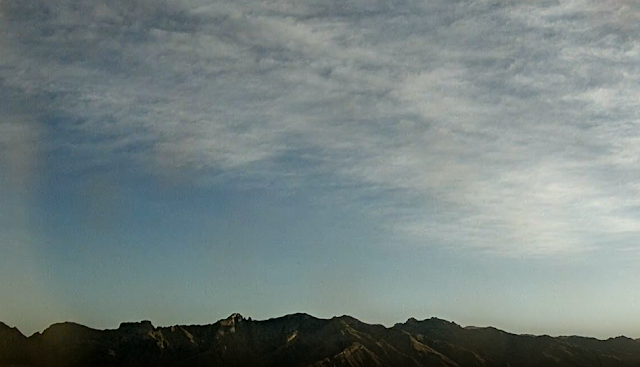
High clouds over the Catalinas at 7:25 am MST this morning.


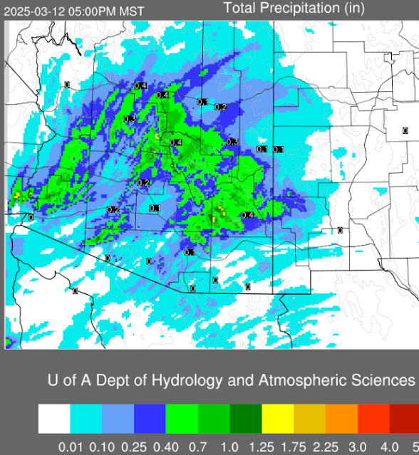
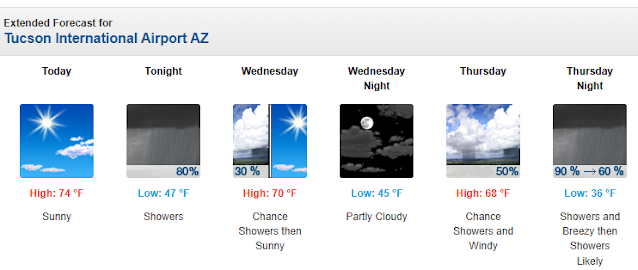
The NWS outlook for rainfall through 5:00 pm tomorrow (above) is similar to this morning's 12 UTC run of the WRF-HRRR (below). Current morning forecast for the airport (second below from the NWS Forecast Office) continues to indicate high POPs tonight and again Thursday night.


Monday, March 10, 2025

Rainy Week Ahead

View of Catalinas at 7:45 am MSTthis morning.


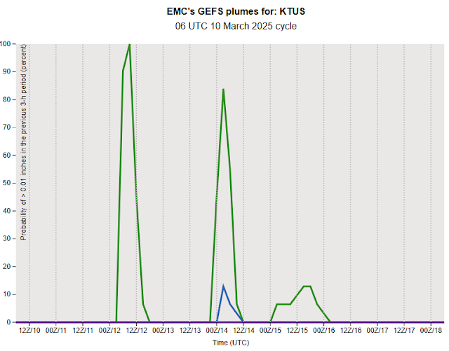
Plumes from the 06 UTC runs of the GEFS are shown here. Those for QPF (above) indicate rainfall events for Tuesday and Thursday nights. Temperatures (below) are forecast to be quite chilly on Thursday night, continuing into the weekend. Forecast precipitation types are shown in the lower graphic. Models indicate a slight chance of some snow being mixed-in on Thursday night.

Saturday, March 08, 2025

Bit More Rain After Dark


General Store view at Summerhaven at mid-morning yesterday.


Rainfall amounts last 24-hours ending at 7:00 a MST this morning. Rain was widespread but amounts were quite light. We had a total of 0.12" here, with some showers after dark and perhaps a small amount after midnight.

View of Catalinas below - a contrast in dark and bright - from campus at 4:35 pm yesterday.

Friday, March 07, 2025

Morning Showers


View of showers moving into this part of town at 9:00 am MST this morning.

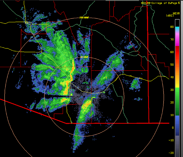
Base scan radar below from the same time.

Wednesday, March 05, 2025

Dust And Snow

Blowing dust yesterday afternoon over southwest Texas. Dust clearly visible on the satellite image below, extending from New Mexico to east Texas. Strong wind gusts indicated on the 4:00 pm CST surface plot (second below).


As the dust plume moved over Dallas skies turned red - above.

The storm has moved northeastward and is now producing blizzard conditions over northwest Iowa and southern Minnesota - view below shows current conditions near Spencer, in northwest Iowa.

Tuesday, March 04, 2025

Quick Look Ahead


Freight train rumbles through snowy Flagstaff during lunch hour yesterday.

The 06 UTC GFS forecast (above) indicates a strong 500 mb closed-low moving into Arizona at 5:00 pm MST on Friday (above). The graphic below (from NWS this morning) shows their Forecast of precipitation valid for 5 am Thursday through 5 am Saturday. Note that last time we had a quarter of an inch of rain here at the house was in November last year.

Sunday, March 02, 2025

Winter?


Mike Crimmins' plot for rainfall (https://cales.arizona.edu/climate/misc/stations/index.html) this current water year (Oct.1st to today) above shows how severe our current drought period is.

Here at the house during the just ended meteorolgical winter of Dec, Jan, and Feb we had measurable rain on only 2 days (January 29th - 0.13" and February 14th - 0.02" - total rain 0.15"). The driest winter here was in 2005/06 when there was only 0.04" of rain. This was followed by 0.15 this year and last, and then by 0.31 during 1999/00.

Saturday, March 01, 2025

March Comes In With Wind

Some dust blowing in over the Catalinas a few minutes ago at about 11:20 am MST.


A strong, 500 mb closed low is forecast by 12 UTC GFS to be moving across Arizona at 5:00 PM this afternoon (above).


The passage of this system has led to a Red Flag Warning for most of southern Arizona (above); as well as wind and blowing dust advisories at the airport (below).

Will post a winter summary tomorrow.