
The 500 mb short wave that is digging south along the west coast is centered over central California this morning and continues with very cold air within its core (-36 to -37 C). The system however is fairly moisture starved at this time and is producing precipitation mainly in the Sierra Nevadas. The graphic above shows blended PW from CIRA at Colorado State - analysis valid at 12 UTC this morning (December 30th). The bright blues and browns over Arizona indicate PW less than 1/2" to nearly none. Moisture within the core of the system will impact central and northern Arizona, and we'll have to hope for a nice increase here in southeastern Arizona when the low-level winds become southerly from the GoC - making this event much like the last several.
Graphic below shows the NWS 06 UTC NAM forecast of precipitation through 11 pm on January 1st - forecast continues to keep heavier amounts well to our north.


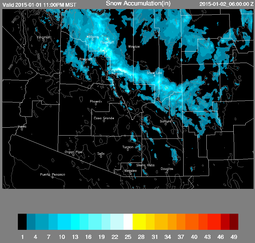
This morning's early WRF NAM, also from 06 UTC, keeps significant precipitation over southeastern Arizona through 11 pm on the 1st (above) at high elevations on the Sky Islands. The model forecast of accumulated snowfall for the same period below indicates heaviest snow on the Catalinas and Mt. Graham. The early WRF definitely forecasts the main Arizona impacts from the White Mountains, along the Rim County, and north to the Grand Canyon.

The WRF NAM forecast sounding for TWC (NWS Office on campus) shown above is valid at 5 pm MST New Year's Eve. It too is similar to recent events with moisture concentrated below 700 mb, and a nasty dry slot above. There is a bit of CAPE in low levels to feed convective showers along and ahead of the cold front that will come by tomorrow late. The WRF NAM has been under-forecasting precipitation amounts during similar events and this may well be the case again.
Finally, the current NWS alert map below indicates a number of winter weather advisories in effect from the Plains to southern California. The widespread wind chill alerts over the Plains reflect the frigid arctic air that has spread southward east of Continental Divide, all the way to the Rio Grande.
The most adverse winter weather with the California short wave will actually occur at week's end, as the system moves eastward over the Southern Plains, producing snow and freezing rain as it interacts with both the arctic air mass and the GoM.


No comments:
Post a Comment