Wednesday, October 19, 2022

Another Windy Morning

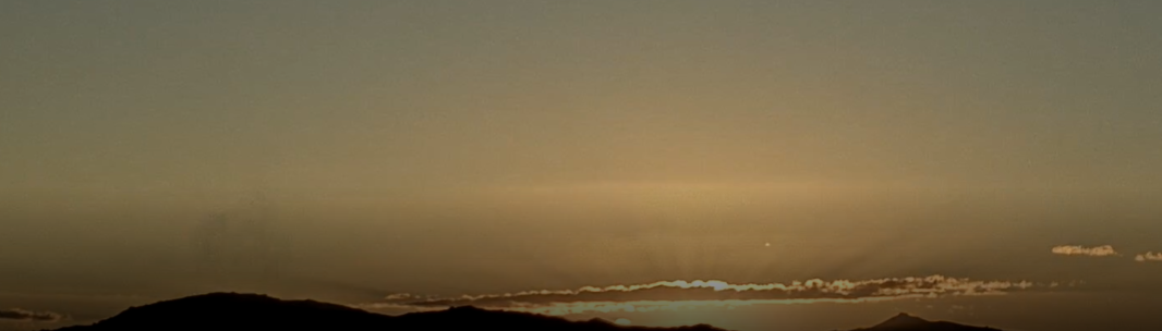
View of the Catalinas from campus at 6:00 am MST this morning.


It's been another windy morning here, after a windy day yesterday. Estimated gusts here at sunrise were around 30 mph. The airport has recorded gusts to 43 mph at both 4:00 and 6:00 am this morning - considerably stronger than current forecast for gusts to around 30 mph. Forecast above is for steady wind speeds and is valid at 9:00 am - from the 12 UTC WRF-RR run at Atmo.

Plumes shown here from the 06 UTC run of the GEFS ensemble members. The PW average (above) remains low through the period; however, there is considerable variance in the forecasts after Friday. The plumes for QPF (below) indicate chances for showers, but again there is considerable variance in timing and amounts. The operational GFS (shown in blue) is a dry outlier. Time will tell, but there may some more interesting weather Sunday into next week.

Monday, October 17, 2022

Isolated Light Showers Yesterday

View looking toward the Rincons at 6:45 am MST this morning. 

There were isolated light showers around the metro area yesterday morning. Three sites in the ALERT network had amounts of 0.04" to 0.08" along foothills and Redington Pass. Nothing noted here at the house. Of note, the temperature here fell into the upper 40s F around sunrise this morning for first time this Fall. 


Plot of detected CG flashes (above from Atmo and Vaisala, for 24-hours ending at 0133 am this morning) shows that thunderstorm cover was very similar to the WRF forecast for rainfall yesterday - see previous post.
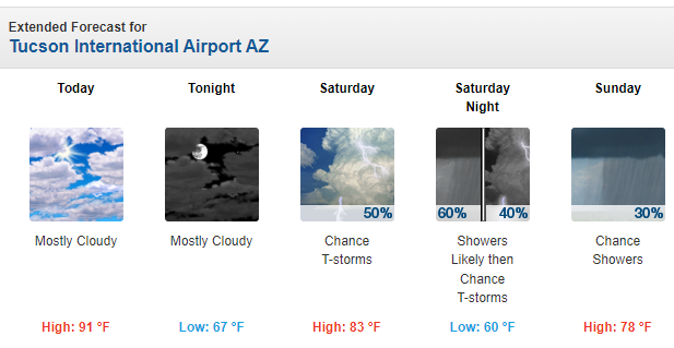
The coming work week looks to be mild and dry, with perhaps a chance for showers by the weekend. Graphic above shows GEFS plumes for QPF at the airport. Image belows shows 06 UTC GFS forevast for rainfall through noon on Monday the 24th. So, a dull outlook for weather watchers.

Sunday, October 16, 2022

Widespread Rains

Nice color with some build-ups looking toward the Rincons at 6:45 am MST this morning.


Thunderstorms were widespread across central Arizona during the 24-hours ending at 7:03 am this morning (plot of detected CG flashes above from Atmo and Vaisala). There were eight reports of severe winds and hail in the Phoenix area yesterday afternoon.


Across the metro Tucson area the coverage of measurable rainfall was nearly 100% - above graphic shows rainfall reports from Mesowest for rain amounts ending at 7:30 am this morning. Here at the house we had only 0.02"; airport had a Trace; DM reported 0,15"; and Atmo had 0.08".


The morning TWC/TUS sounding (above) is a bit weird, but there is some lingering CAPE (not nearly so much as SPC analysis indicates). The 500 mb analysis (below) shows the cyclone centered out west of Tucson.


As the 500 low moves across southern Arizona today there will be a chance for some light showers; however, the WRF forecast runs at Atmo forecast that most rain/showers today will remain well northeast of our area. Graphic below shows 12 UTC WRF-RR forecast of precipitation amounts through midnight tonight.

Friday, October 14, 2022

Weekend Showers?


 Some nice pre-sunrise over the Catalinas at about 6:15 am MST this morning. I have been away for a couple of days, but am back in time to see some weekend showers - I hope.


Very, very quiet across the continental US and northern Mexico yesterday and last night. Plot of detected CG flashes for 24-hours ending at 3:01 am this morning (above, from Atmo and Vaisala) shows only thunderstorm activity was a small cluster west-southwest of Houston.


The morning sounding from TWC/TUS (above) is dry and very stable. However, a weak, closed low at 500 mb is forecast to move from off southern California eastward across southern Arizona during the weekend. The 500 mb forecast below is from the 06 UTC GFS and is valid at 12 UTC on Sunday morning.

Plumes from the 06 UTC GEFS (above for QPF) all indicate precipitation at the airport from the 15th into the morning of the 16th. The current NWS Forecast Office outlook through Sunday (below) reflects the GEFS forecast above. 

However, the 12 UTC WRF-RR forecast of precipitation through 5:00 pm Sunday afternoon (second below) is considerably less optimistic. So a weather watchers' chance to evaluate how the differences play out.

Monday, October 10, 2022

Isolated Thunderstorms


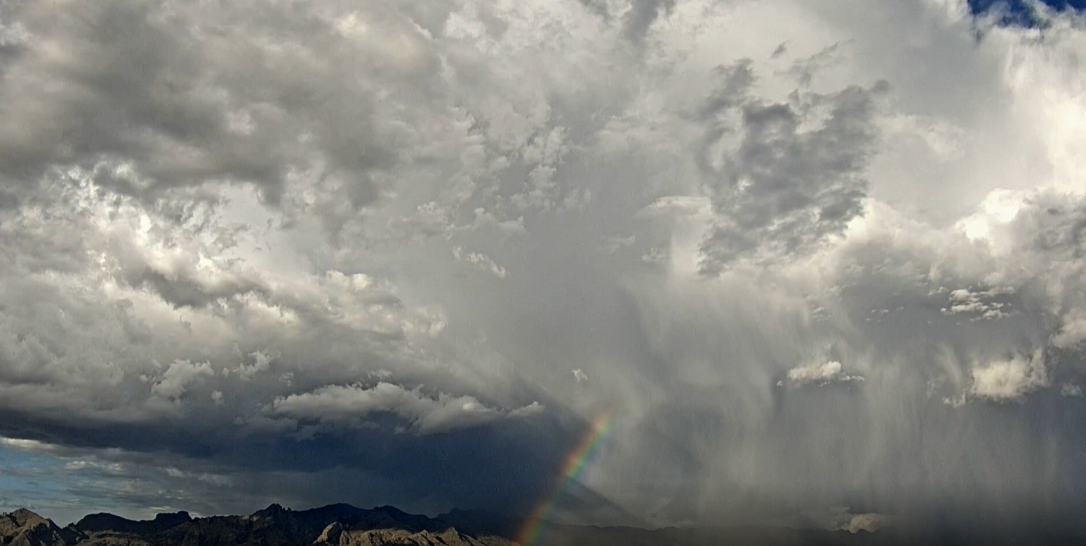
View of storm on Catalinas with partial rainbow and precipitation shaft that appears to have some hail in it (image from 5:00 pm MST yesterday). Down at bottom is this morning's view of fair skies at 6:40 am.

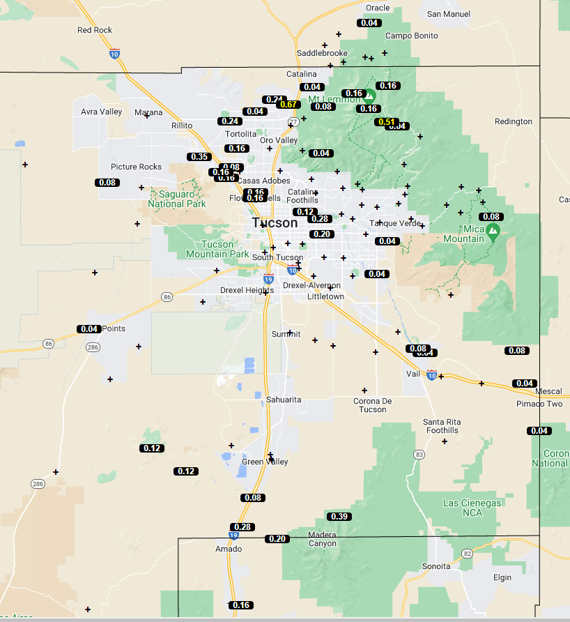
Plot of detected CG flashes for 24-hours through 0103 MST this morning indicates limited thunderstorm activity over eastern Pima County (above from Atmo and Vaisala). The ALERT map below is for 24-hours ending at 6:30 am this morning - activity was mostly over Catalinas and far southeast part of the network. Only site with over half an inch was hit by storm shown at top. 


The 500 mb pattern continues to be very weak and disorganized over the southwestern US (above). The morning sounding from TWC (below) has slight CAPE and light/variable winds below 300 mb. Models do forecast isolated thunderstorms over the metro area this afternoon and evening.


Saturday, October 08, 2022

Bit More Rain


Sunrise color looking toward the Rincons at 6:25 am MST this morning.

Considerable CG flashes across southeast Arizona yesterday afternoon as per plot above showing detected flashes (from Atmo and Vaisala). Rainfall was scattered here and there across the ALERT network - plot below for 24-hours ending at 7:00 am this morning. Here at house we had 0.12", while Atmo, TUS, and DM reported no rain. Winds were quite gusty across the metro, with speeds of 30 to 40 mph common.


The weak 500 mb low is centered over the northern GoC this morning (above). The 12z TWC/TUS sounding (below) is moist with light winds, but with no CAPE. We will need considerable heating and/or additional moisture for storms this afternoon. However, the 12 UTC WRF-RR does forecast storms over the metro by midnight tonight (second below).


Friday, October 07, 2022

Rain Last Three Days


View of Catalinas at mid-day today, with building cumulus just starting.

Down at bottom is view at 1558 UTC (2:58 MST) yesterday just before rain began here at house.

Radar at 4:10 pm MST yesterday, just as rain was starting here. Below is ALERT rainfall graphic for 24-hours ending at12 UTC this morning. Rainfall was scattered here and there at only a few sites across the network. Here at house we had a heavy downpour from the small cell northeast of downtown. Final amount was 0.77" (note that on Tuesday and Wednesday we had 0.17: and 0.13" - putting us over an inch already for October).

 Second below shows detected CG flashes (from Atmo and Vaisala) for 24-hours ending at 1153 UTC this morning - activity was fairly significant across southeast third of Arizona.


Update

Readers - serious computer problems here have kept me from posting, but I hope to resume in a bit. Bob

Sunday, October 02, 2022

October Second


View looking toward the Rincons at 5:45 am MST this morning. 


Very few CG lightning flashes yesterday afternoon - plot of detected flashes for 24-hours ending at 5:03 am MST shown above (from Atmo and Vaisala). A storm west of the Catalinas produced CG flashes around dark. Only five ALERT sites reported light rainfall during the 24-hours ending at 6:00 am this morning (below) - all were outside the main metro area.


The two ALERT maps shown here are for total September rainfall. Some isolated sites along I-10 had less than half an inch, while several others had over three inches. Here at the house we had 1.43", which is about average for September during past 23 years. Total here at house for June-September was 8.45".

Hurricane Orlene (IR image at 1830 UTC today below) developed off coast of Mexico yesterday and rapidly intensified to a Cat 4 storm (winds of 130 to 156 mph). At the current time the storm is weakening and forecast to make landfall in western Mexico before reaching the GoC.

Saturday, October 01, 2022

September Ends With Rain Event


Thunderstorm along the foothills at 4:03 pm MST yesterday afternoon, as September ends with storms and scattered rain. Plot of detected CG flashes for 24-hours ending at 0133 am this morning is shown below (from Atmo and Vaisala). There was considerable lightning in eastern half of Pima County, but not much in the north metro area. There was rumbling thunder here, but I didn't see any flashes.


The rain was hit and miss, with many ALERT sites recording nothing (nothing meaning, if there was rain it was less than 0.04"). We had 0.22" here, as did Atmo; the airport recorded 0.27", and DM reported 0.28".


The 500 mb setting remains a mess over the Southwest. The weak low is still centered over northern Sonora.

The morning sounding at TWC/TUS (above) continues with over an inch of PW, but with limited low-level moisture and almost no CAPE. The 12 UTC WRF-RR forecasts only a few light sprinkles across Pima County - below, shows total rainfall through midnight. This does look realistic to me, given yesterday's rain event and the morning sounding.