Tuesday, December 13, 2011
Storm Update 8 AM Tuesday December 13th
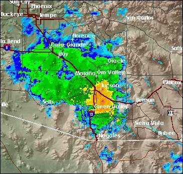
Yesterday morning I measured 0.26" here at house between 9 am and noon, after the first band of showers had passed. Then there was only a trace from noon yesterday through 5 am MST this morning. But a heavier and more persistent band of showers moved in just after 5 am. Current view from campus looking toward north is above. Current view from Kitt Peak looking north (below) shows that precipitation is now snow there (elevation 6880 ft MSL). Since rain started again this morning, an additional ~0.40" has fallen here at the house. Image at the bottom is current KEMX composite radar image, showing a significant area of moderate rain over the Tucson metro area. Good day to stay in and read a book! But, alas, it is Finals week at U of A, and the students have to slog-in through this mess for exams. There may be a lot of reports of dying uncles and grandparents providing excuses for the students not brave enough to venture out today.
Subscribe to:
Post Comments (Atom)


No comments:
Post a Comment