Pre-sunrise view from Atmo this morning. Current morning statement from NWS below.
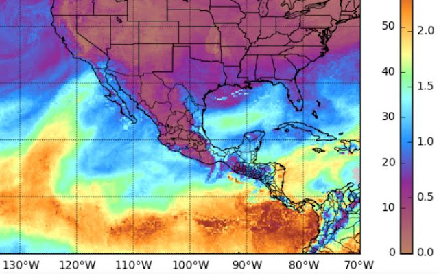
Above is plot of TWC morning sounding - PW up over three quarters of an inch but with three strange very dry layers below 500 mb. These are apparently real, since other soundings nearby show similar structures. The MIMIC total PW analysis for 13 UTC this morning (below) indicates PW amounts of around an inch intruding into southwestern Arizona.
GFS forecast of 500 mb winds and heights above is valid at noon Monday and indicates the short wave, with perhaps a small closed low center across Arizona. Trough axis not forecast to be as positively tilted as was forecast yesterday - a favorable change for showers here.
Forecasts for event event total precipitation amounts: above from ATMO's 06 UTC WRF-NAM and below from NWS morning statement. Note the WRF donut hole over Tucson metro. The GEFS plumes for rainfall at TUS indicate about half an inch or bit more for event. Event is developing to be considerably netter than the sprinkle showers on morning of December 4rth.


No comments:
Post a Comment