
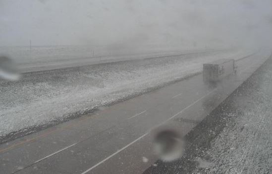
Another morning with cloud-free skies to end the week. However, places to our north are experiencing a very late snow storm - bottom views show I-80 east of Cheyenne, Wyoming, and also campus of University of Wyoming in Laramie.

There is a large and very cold 500 mb trough sagging into the western US this morning (above) - the temperatures approaching -30 C. The trough has moved little by 12 UTC tomorrow morning (forecast below from 06 UTC GFS forecast this morning).


Locally, we can expect winds and perhaps some dust and more misery for allergy sufferers. The NWS has out a Red Flag warning for most of the southeastern part of Arizona - see above. Forecast from 12 UTC WRF-RR (below) indicates steady winds at airport reaching 29 kt (33 mph), so gusts will likely approach 40 mph, or bit more, in some spots across metro area.

Graphic below shows various warnings and advisories in effect this morning over northeastern Colorado. Forecast for Boulder calls for 6 to 12 inches of snow through the day tomorrow. Trees are leafed out, so there is potential for major damage.


No comments:
Post a Comment