
Heavy cloud cover over metro and Catalinas a bit after sunrise this morning.

Graphic this morning on NWS webpage (above) focuses on lightning safety - a good graphic that I don't recall seeing before. It's important because the two most significant weather hazards here in southeast Arizona are lightning and flash floods.
Plot of detected CG flashes below is for 24-hours ending at 5:03 am MST this morning. Note that storms avoided much of the Tucson area. There was thunder and Trace of rain reported at both the airport and DM (also gust to 38 mph at the AFB).


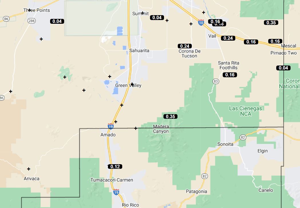
ALERT plots (above and below) are for 24-hour rainfall ending at 7:00 am this morning - only 25 scattered sites reported 0.04" or more, with max amounts on the Catalinas.

This morning's 500 mb analysis (above) shows light and variable winds over the Southwest, with the large anticyclone center over southern Arkansas. Band of higher RH at this level covers eastern Arizona and much of New Mexico.

This morning's sounding is much like yesterday's with fairly dry air below 700 mb, little CAPE, and light/variable winds below about 450 mb. The 12 UTC WRF-RR forecast for rainfall through midnight tonight (below) indicates only some spotty light showers for eastern Pima County. Note that yesterday's WRF-RR forecast verified quite well (see previous post).

No comments:
Post a Comment