Wednesday, January 09, 2019

Middle Clouds And Light Sprinkles Today


Middle-level clouds with some virga and light sprinkles across southeastern Arizona this morning as a weak 500 mb short wave approaches. Webcam images above and below are from Kitt Peak and campus.


Visible image above is for 11:15 am MST and radar below from 10:32 am. The line of 30 dBZ echo is quite prominent in both satellite and radar views.


Monday, January 07, 2019

Event Totals


Thick fog and low visibilities around this morning at sunrise - above near airport and below Kitt Peak clear but with fog in valleys to east and west. Clear here on north side of City.


The precipitation event that ended mid-morning yesterday produced rains across the metro area of generally half an inch to an inch (above), with Amounts in mountains reaching to over two inches of rain. Here at house final total was 0.85".

Another event during the next week or so? Models are over the place beyond two days - some forecast yeas and some no, and some everything in-between, The scatter in the GEFS is illustrated below, which shows the ensemble plumes for PW. So, we'll have to wait to see how the pattern actually evolves.

Sunday, January 06, 2019

Quick Update Sunday Morning January 6th


All images here are 7:00 am MST or 24-hour totals. Precipitation at Summerhaven General Store has turned to snow after heavy rains on snowpack.


Statewide precipitation indicates widespear event producing measurable amounts almost across entire state (from MesoWest).


ALERT rainfall measurements for the night (north above and south below). Many amounts over half an inch across metro and northern part of ALERT domain. Amounts approaching two inches up in the Catalinas with likely significant streamflows this morning. Current, composite radar at bottom.


Saturday, January 05, 2019

Models Forecast Huge Increase in PW


South view from Kitt Peak this morning at about 7:00 am MST shows high clouds at top right corner - these are approaching from the southwest.


Two forecasts, from the 06 UTC run of the WRF GFS on 5.4 km grid, of PW (in mm) shown here: Above is valid at 6:00 am this morning, while below is valid at 6:00 pm this evening. There is forecast to be a large increase (nearly tenfold) in PW during the day across southwestern Arizona. 

The moisture increase comes along with a significant precipitation event for southeast Arizona during the night. Forecast of QPF for TUS (bottom) is from the SREF system at EMC. The members forecast the event to produce most of its precipitation during the night tonight. The range in forecast amounts is from about 0.15" to about 1.20 " - very large spread, but most of members are clustered more tightly around the ensemble average of about 0.60". We'll have to watch the details as the event evolves today and tonight.


Friday, January 04, 2019

Quick Look At This Weekend And December 2018 Summary

 First - unusual tropical cyclone could develop into a storm during next 5 days as per NHC above, This would be a very late event, since since TS season ended over a month ago.

The GEFS plume forecasts from 06 UTC continue to indicate a distinct rise in PW (above) from low-latitudes. The plumes for precipitation QPF (below) continue to forecast an event for Sturday night into Sunday. The GEFS average amount for TUS is 0.30" and most ensemble members are clustered around this value. Also looks like another event possible late in the coming week.


SUMMARY FOR DECEMBER 2018

There were four precipitation events with measurable amounts during the month - two of these were events that spanned midnight and so were two day events. The total for rainfall was 1.23" (vs 0.39" last December), which is the 4th wettest December in my 21 years of record s here at the house. One day had thunderstorms here at house, with a second day possible but unknown.

There were 8 days with morning lows of 32 F or colder (vs 9 days for last December) and 3 of these days had lows of 25 F and colder.

Thursday, January 03, 2019

Catching Up A Bit


We have been away a couple of days and missed the snow excitement here in Tucson. However, we did experience a bit of snow at Santa Rita Abbey near Sonoita (above). Art Douglas sent the photo below of snow cover at his place in Ash Canyon (south of Sierra Vista) . Art also sent Mexican surface observations for the stations in northern Mexico south of Arizona. The previous system (which dug far south over Mexico) resulted in temperatures in the range of 10 to 15 F - which is very cold for down there.


A quick look at 06 UTC WRF-GFS forecasts indicates that the next system, over the weekend, will have a substantial influx of moisture from low-latitudes, and thus more potential for heavier rains. Forecast above shows PW (on 5.4 km grid) valid at 9:00 pm MST on the 5th. Below is the same run's forecast of precipitation through 11:00 am on Sunday the 6th.

More later.

Monday, December 31, 2018

Quick Look At Our New Year's Storm


Photo above from south entrance to Grand Canyon National Park, where moderate snow has already been reported this morning.

The 500 mb analysis from NCAR (below) shows that the strong, short wave is over the Great Basin, oriented from west-southwest to east-northeast. The closed low part of the system will move across northern Arizona tonight and tomorrow, while southern portion of wave swings across southern Arizona. Note that core of system is very cold, with temperatures around - 36 C.


This is another storm with limited moisture, as per 06 UTC GEFS plumes for PW at TUS above. Models forecast a much deeper intrusion of moisture from low latitudes next weekend. The plumes for QPF at Tucson (below) average just less than half an inch. The 06 UTC WRF-GFS forecasts an amount of 0.70", while this morning's 12 UTC WRF-RR forecasts only 0.20". Snow accumulations will occur very close to our east and southeast, still with some chances of a few flakes mixed in over parts of the metro area.

The WRF forecasts continue to indicate strong winds of 20 to 30 mph ahead of the cold front this afternoon and evening. Data from Mt. Hopkins are now available - the RAWS site there had maximum gusts of 56 mph at 2:00 am MST yesterday morning.

Looking forward to a new year!

Sunday, December 30, 2018

Stormy Start To New Year in Southeastern Arizona


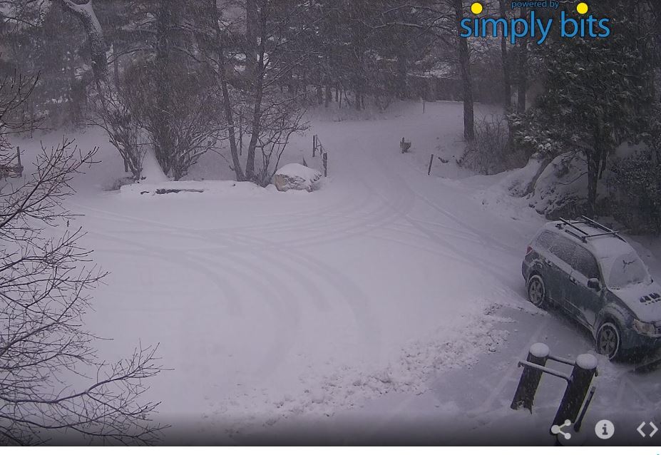
First, cold and snow yesterday morning - two views of higher foothills of Catalinas with first visible snow of winter. Above is from my later-than usual morning walk, and view below from the Ferner's looking across our circle.
Temperatures were very cold with the low here dropping to 23 F (currently 24 F this morning) - there was moderate frost and ice on the puddles when I walked.


Above is this morning's  500 mb analysis from NCAR. The very cold, closed low over northwest Sonora is probably causing many temperature problems for so far south and likely snows in the mountains. Below is this morning's NAM forecast of the 500 mb level valid at 5:00 pm MST tomorrow evening. The strong short wave currently over the Northwest digs southward, into the long-wave trough that has persisted for a number of days over the west-central U.S., and is entering northwestern Arizona.


The 06 UTC QPF plumes for the airport from GEFS (above) are very similar to the last two events, forecasting amounts at airport of 0.30" to 0.40" during the night tomorrow. The GEFS actually has 20% to 30 % chances for some snow mixed with the rain by morning on New Years. The forecast below of snowfall through 5:00 am on 1st is from the 06 UTC run of the WRF-GFS at Atmo. If forecast were to verify, road conditions late New Years night would become very dicey on Highway 83 south of I-10 - same for Texas Canyon on I-10 east of Benson.


Finally, a bit about the winds. I wasn't paying close attention to WRF forecasts and Mt. Hopkins is apparently have a 50 - 60 mph high wind event event this morning, although RAWS observations are missing since midnight last night.

As the shortwave approaches tomorrow afternoon winds from the southwest become quite strong over southeastern Arizona. The forecast below is valid at 5:00 pm tomorrow afternoon. If you're going to be out and about New Year's eve, take care.


Friday, December 28, 2018

Summary Of Yesterday's Event


Very thick clouds and light rain at 5:00 pm MST yesterday afternoon - light showers began here at house around 3:30 pm. The two webcam views from the General Store in Summerhaven below are from 5:00 pm last evening and at 5:00 am this morning. Looks like around four inches of new snow up there on the mountain.


The ALERT observations this morning from 5:30 am, for past day, indicate this widespread event was a bit wetter than the preceding one this week. There were 7 sites with over half an inch yesterday. Here in the metro the precipitation had generally ended by 11:00 pm, so this event was mostly on the 27th. Little thunderstorm activity with this event - CG flashes were detected in Pima County, but mainly far out at it's west edge.

Here at house we had 0.30"; TUS had 0.32"; DM measured .32": and Atmo recorded 0.24". December now stands at a bit over an inch. The next digging short wave at 500 mb may bring another quick round of showers late on 31st and the first day of 2019. December has certainly been much different than November here.


Thursday, December 27, 2018

Next 500 mb Short Wave Approaches


First short wave from 36-hours ago is producing blizzard conditions over parts of Northern/Central Plains - above is webcam from Lexington, Nebraska.

This morning's 500 mb analysis from SPC (below) indicates the next short wave is currently over the Northwest - from Idaho southward across Nevada.


The 06 UTC GEFS plumes forecast this low-moisture system will  pass quickly by tonight - forecast for PW above spikes at a bit less than half an inch, while QPF forecast for TUS (below) has average of less than 0.20" - forecasts similar to last event. The 06 UTC run of the WRF-GFS at Atmo forecasts a period of gusty southwest winds this evening - forecast at bottom valid at 8:00 pm MST later today. 


Wednesday, December 26, 2018

Brief Summary Of 25/26 December Precipitation


Peaceful snow scene before sunrise at the Summerhaven General Store - looks like several inches up there.


Another widespread event, but with light precipitation amounts - generally around 0.20" to 0.30". ALERT observations (above and below) are for 24-hours ending at 6:30 am MST this morning. The airport had 0.26"; Atmo had 0.23"; here at house we got 0.21"; and DM measured 0.20". The airport had gusty winds to around 40 mph ahead of front and then reported thunder in one observation. Precipitation occurred before and after midnight, spanning both the 25th and 26th. Timing and amounts for GEFS average (post yesterday) were quite good for our area. 

The plot of detected CG flashes (at bottom) shows thunderstorms occurred over much of Pima County - there was a small cluster of flashes south of airport that is hard to see on the plots. No thunder here.

A trailing system from the north will come through during early hours of 28 December (Friday). While there will be precipitation again, it appears that this second system may be even more moisture-starved than the one that has just passed.