Saturday, June 20, 2020

Fire Burns ON


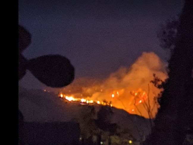
Fire continues very active on the southwest flank - view above from our courtyard about 8:30 pm MST last night. Chemical drop on fire from DC-10 (below - day and time uncertain).


View from campus at sunrise this morning above. Boundary map for fire below from early this morning. Fire continues to spread toward north and east, and also some on southwest flank as seen in photos above. Area burned is approaching 50,000 acres - another real tragedy for the Catalinas.


Meanwhile, the weather will continue hot and dry, probably through end of month. Forecast for total precipitation precipitation above is from 00 UTC WRF-GFS and ends at 5:00 pm on June 27th. Forecast below is for PW at that time - deepest moisture still far south of our area.

far south


Friday, June 19, 2020

Quick Update On Fire


Two photos of the Bighorn fire smoke plume at around 3 pm MST this afternoon (above from Atmo and below from neighbor Jodi Ferner). It appears that the southwest flank of the fire remains very active today. I suspect that fire fighting efforts are concentrated on the north flanks of the fire, as it moves slowly toward Oracle and San Manuel.


Thursday, June 18, 2020

Fire Update/Coming Week


Views of the smoke plumes from Arizona wildfires yesterday (Bighorn fire) above, from neighbor John Ferner, and second below from Atmo webcam.

Satellite view below sent by Jack Diebolt (who's back in southern Illinois) shows smoke plumes  from (south to north) the Bighorn fire, the Bush fire, and the Mangum fire. Note the widespread smoke trapped in lee of Rockies over Colorado.


The 00 UTC GEFS forecast of QPF for TUS (above) is flat-lined for coming week. And the GEFS 500 mb forecast below (valid the 28th at 00 UTC) shows that we're in the summertime ridge for rest of month. Big question is whether or not embedded features might act to start pulling eastern Pacific moisture northward. It is currently very dry all the way down to Cabo Corrientes.

Wednesday, June 17, 2020

Update - Bighorn Fire


Photo of Bighorn fire smoke plume (above) from here at about 3:45 pm MST yesterday - there was a bit of pyrocumulus at top of plume. Below is view of fire from Atmo movie around 1:00 am this morning. At bottom is photo of the Bush fire along highway 87 northeast of Phoenix.


Fire boundary above bit before midnight last night - fire has burned an estimated 18 to 20 thousand acres and the map below shows area evacuated yesterday evening - area includes town of Summerhaven.


Tuesday, June 16, 2020

Fire Continues/Thunderstorms in Cochise County/Monsoon Season


The Bighorn fire continues moving east and northward in the Catalinas this morning. Fire fighting efforts are focused on protecting Summerhaven from the blaze.


There were thunderstorms over Cochise County yesterday (radar above from 4:15 pm MST). Storms and showers redeveloped in eastern Pima County and affected parts of the metro area - radar below from 6:20 pm and 24-hour plot of detected CG flashes second below (from Atmo and Vaisala). 


Yesterday, June 15th was the start of the NWS "Monsoon Season" for southeastern Arizona. The 12z 500 mb analysis this morning shows that the monsoon high (anticyclone) is currently centered over north-central Mexico somewhere east of southern end of Baja.

However, current forecasts indicate that the high will shift northward and be centered along the New Mexico Arizona border during the latter part of next week. Will showers and storms follow quickly?


Monday, June 15, 2020

More Bighorn Fire Photos

The photos below are from Ron Holle in Oro Valley, taken looking approximately east to east-northeast.


Above from 6:30 pm MST and below from 7:37 pm - both on June 6th.


Above from 8:12 pm on June 6th and below from 8:23 am on June 11th.


Above from 3:32 pm on June 11th and below from 1:29 pm on June 13th.

Sunday, June 14, 2020

Sunday Mid-Day June 14th


The Bighorn fire continues to grow and has moved toward north and west some, so that the smoke plume is now barely visible from here. View above from 10:52 am MST this morning from campus.

The fire is still only about 10% contained and has grown to around 15,000 acres. It is mostly burning in very rugged and inaccessible terrain. 


Two views from Oro Valley yesterday - one in afternoon and one after dark. Exact times are not known.


There were thunderstorms yesterday afternoon along about the eastern fifth of Arizona. Plot above of detected CGs is for 24-hours ending about 5:00 am this morning.

Model forecasts indicate some chances for thunderstorms near the metro area. Forecast of composite radar echoes below is from the 12 UTC WRF-GFS and is valid at 5:00 pm tomorrow. It is mid-June and an actual storm, with rainfall, in the lower elevations of metro area would be very unusual.


Friday, June 12, 2020

Quick Update June 12th


The Bighorn fire continues in the west end of the Catalina. Photos above were from sunrise yesterday and early last night - views from the southwest of the fire. There were evacuations in the western foothills late yesterday.

Best fire map that I could find this morning is below, showing area burned in pink - size of area exceeds 7,000 acres.

Models from last night vary wrt the wind speeds today - some continue to forecast speeds 20 to 30 mph, while others are lighter.

Forecast at bottom is from the 12 UTC WRF-RR this morning - that run forecasts very strong winds on Sunday afternoon (forecast valid at 7:30 pm MST).

Will just have to watch what actually happens next thee afternoons. Models do forecast an increase in PW today, but afternoon RH remains near 10 percent next several days.


Thursday, June 11, 2020

Bighorn Fire Thursday June 11th


Three views of the Bighorn fire: Top - Katie took this from our courtyard at midnight last night; above and below are views from campus at 6:00 am MST and at 11:00 am. We were in smoky air here at sunrise because of light drainage winds.

Morning run of the WRF-GFS forecasts strong easterly winds for the early morning hours tomorrow - at bottom.

Foothills residents have been put on alert for the possibility of evacuations if fire creep further down the mountain.


Wednesday, June 10, 2020

Bighorn Fire Continues To Burn In Pima Canyon


Two views of the smoke plume from the Bighorn fire taken about 7:45 am MST this morning. Appears that overnight smoke drained down into the Oro Valley area. Winds aloft today are light southwesterly below 600 mb, so the smoke will gradually shift toward Oracle.


Strongest winds in the 06 UTC WRF-RR forecast from Atmo remain over New Mexico today and tomorrow. Forecast winds above show a number of strong, anticyclonic out flows that have been generated by thunderstorms. Forecasts above and radar below are both valid at 6:00 pm MST tomorrow afternoon.


Tuesday, June 09, 2020

Smoky In North Part Of Metro


Katie took this photo of the Bighorn fire/smoke around 11:00 am MST this morning - view is looking northeast from Ina and Oracle. Views below from campus at 2:00 and 3:00 pm this afternoon.