
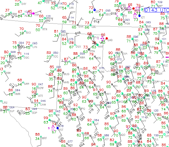
There have been a wide variety of interactions among a weak, large-scale cool front; the High Plains dryline; a very strong south-southeast influx of hot and very moist air from the Gulf; and numberous convective and mesoscale outflows the last several days, particularly over Oklahoma and west Texas. I noted a number of back-building MCSs over Oklahoma contributing to the extreme rains and flooding. Shown above are a dryline bulge across Amarillo on Sunday evening. Top is the WSR-88D reflectivity Sunday evening showing the bulge (I don't know what the strange "V" signature is. The nearly concurrent surface data are shown in lower panel.
No comments:
Post a Comment