
Yesterday was dominated by the warm rains associated with the remnants of TD-16. The CG flash density plot above (from Vaisala and Weather.Graphics) shows flashes through 5:00 am MST this morning - thunderstorm activity remained well to the south and west of our part of the state. Most active area was out in the Pacific with the separate, 500 mb closed low.

Rainfall was very heavy during the day yesterday, as indicated by the ALERT sectors shown here - metro east above and metro west below - heaviest rains in these sectors fell in Redington Pass area and the Rincons, but amounts near or over an inch were common. Here at house we measured exactly an inch, with the event over by around 3:00 pm.
Amounts in other sectors included 6.42" at the Mt. Lemmon site and 3.27" at Florida Canyon in the Santa Ritas. So, the subtropical component of the event was a very effective rain producer for the southeast corner of the state.

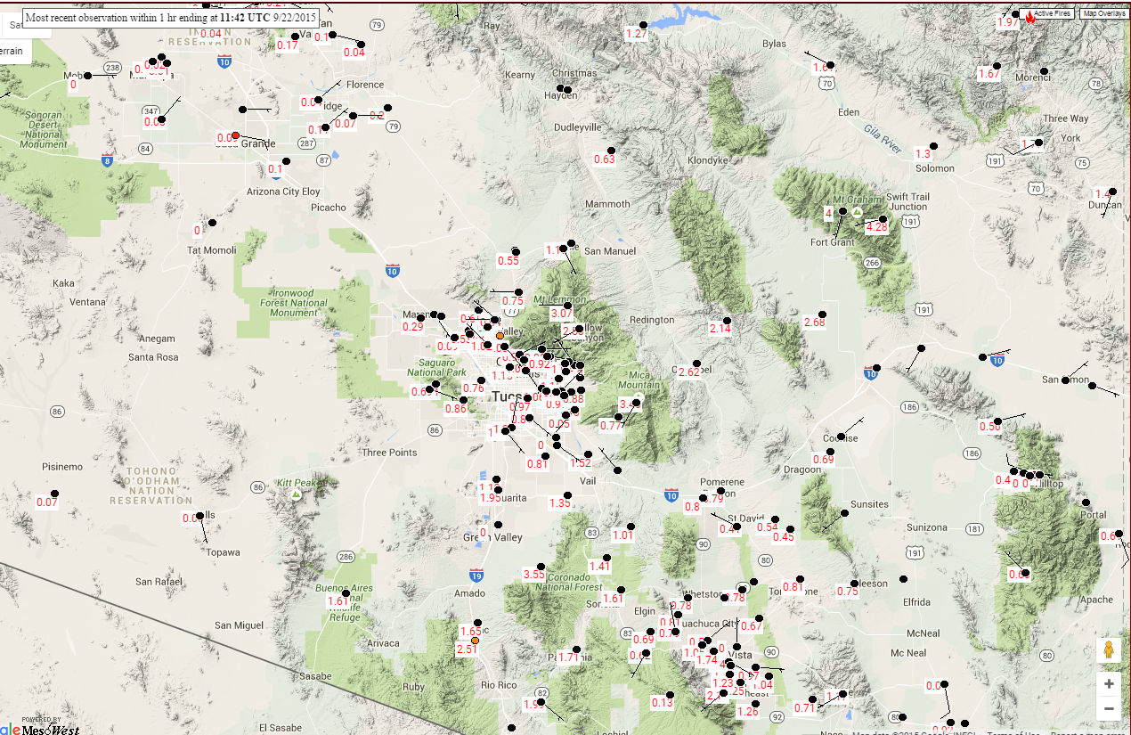
I grabbed 24-hour rainfall from MesoWest (below for period ending at 5:00 am) but the scaling is not very good. Because the models were quite variable on the location of the swath of heaviest rainfall, I wanted to show that the model forecasts that focused on eastern Pima, Santa Cruz, Cochise and Graham Counties were clearly the winners. If you were in Ajo or Picacho, this event seemed similar to mid-September last year, when the remnants of Hurricane Odile dumped on Cochise and Santa Cruz Counties but left Tucson metro high and dry.
The NWS guidance on Sunday, see earlier posts, jumped on the western track for the heaviest rains and have so far been mostly a serious bust - but the final day of the event will be tied to the progress of the 500 mb short-wave across central and northern Arizona, so all the returns are not in yet.
No comments:
Post a Comment