
View of the Catalinas this morning (above) shows heavy cloud sitting on the mountains, but with a bit of blue peeking through. Yesterday was extremely dreary down here in the metro area, but essentially precipitation free. The two sectors of ALERT network data shown below (Catalinas and then metro east) indicate precipitation for 24-hours ending at 6:30 am MST this morning. Rain and perhaps some snow was confined to high elevations - nice example of nearly 100% POPs for the mountain zone and nearly 0% for the low elevation forecast zone. The WRF model forecasts from Atmo were actually quite good in their forecasts for this period, keeping precipitation up on the mountains (see second post below).


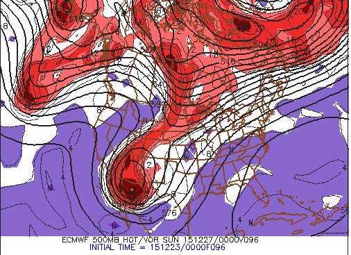
For such a strong 500 mb closed low coming by (ECMWF 500 mb forecast valid at 5:00 pm Saturday afternoon shown above), the models continue to forecast a fairly dry, but cold, storm with precipitation most likely to continue over the higher elevations. The WRF-NAM forecast from 06 UTC this morning (below) continues with little forecast for the metro area in the way of precipitation. The WRF-GFS forecast is much drier - the reason for this is shown clearly in the plumes QPF forecast below. This seems to be a continue to watch and see what happens situation, as the low closes off nearby - thickness values will probably be cold enough for snowflakes down here in metro area Saturday, if there is any precipitation occurring.


Quick look at some plumes from the 06 UTC GFS ensembles for the period through the Christmas weekend - above is QPF for Tucson. There's little to be excited about from the model for the airport station (TUS). Spits and sputters of light showers through Saturday night, but with light amounts forecast. Note that the operational version of the model (blue) is a seriously dry outlier.
The 06 UTC plumes for El Paso are much more interesting - just below are the QPF plumes that indicate a significant precipitation event for late Saturday afternoon into Sunday, but with substantial spread in the forecasts. The precipitation type plumes at bottom shows the models forecasting an event that starts as rain (green), but then quickly turns to snow (blue). If the model forecasts are accurate, the Sun Bowl football game will just be ending about the time the weather sets in.


No comments:
Post a Comment