Sun breaks through to highlight the University a bit after 5:00 pm MST yesterday. Denver (bottom) had a very fiery sunset yesterday.
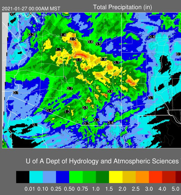
Showers yesterday totaled mostly less than a quarter of an inch, except on west side of Tucson Mountains, with much of the main metro area mostly missing out. Couple of sprinkles here but nothing measurable. ALERT (above) and MesoWest (below) observations are for 24-hours ending at 6:00 am this morning.
Now I'll wait for next system and hope for a better outcome here at the house. At 500 mb another closed low is forecast to cross Arizona Sunday (above) with trailing system re-enforcing the Southwest trough by Tuesday (below).
Models (GEFS above, and 00 UTC WRF-GFS below) again forecast a significant precipitation event for Arizona, although amounts were biased considerably too high by last event's forecasts. We'll wait and see how the situation evolves, beginning Sunday. Wouldn't take much to beat the meager 0.05" here so far in January.
The 06 UTC GEFS plumes for temperature are shown second below. Cold Sunday through Tuesday but then a rapid warming rest of week. Looks like another morning here with temperatures down in the 20's Wednesday.


No comments:
Post a Comment