
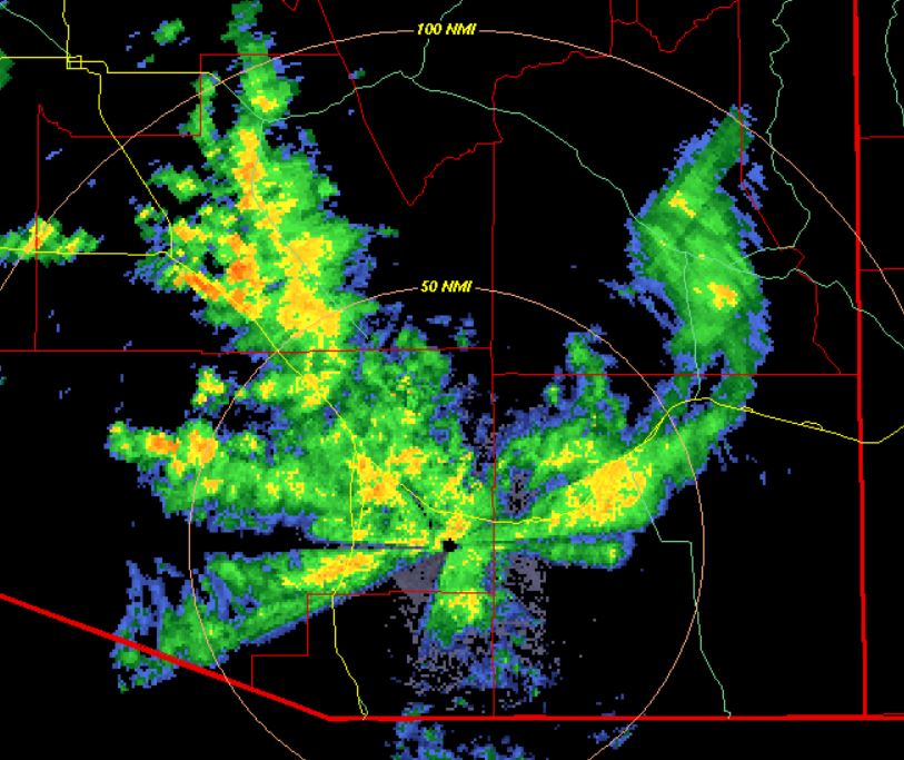
Heavy clouds over the Catalinas, with light showers over most of the metro area this Sunday morning. The base scan radar below (from 8:12 am MST) shows current distribution of echoes around the region.

Data from the ALERT network through 7:00 am (north sector above and south below) show general heavy rains of one to two inches plus over the entire network (note that there is one site south of Three Points that is not functioning). I see one station on Mt. Lemmon had just over three inches. here at house we have had only 1.45 inches.
Second graphic below indicates detected CG flashes for 24 hours ending at 6:53 am this morning - for the second day in a row southeastern Arizona has had essentially no thunderstorms, just heavy showers.


The low at 500 mb (above analysis from Univ. of Wyoming) has shifted now to southeastern Arizona and appears to be centered just to our north-northeast - the 300 mb chart (below from SPC) has the low positioned about correctly.

Finally, this morning's sounding came in a bit late and many analyses were done before there was data from TWC/TUS. Sounding below from SPC continues very moist (PW of 1.90 inches), with mostly light winds, and just a tiny sliver of CAPE.

No comments:
Post a Comment