Tuesday, November 12, 2013

Backdoor Front Easing Into Southeast Arizona


Edited to add - An interesting walk this morning along the Rillito. Here at house before sunrise it was calm and 43F. By the time I neared the Rillito at north end of Country Club strong east winds broke through with gusts of 20+ mph and instant warming of at least 15F. Headed west on north side of Rillito. When I neared the Campbell bridge the wind went calm again and then became light westerly with an instant change back into the cold air. This continued until the north end of Cactus and then winds went calm with a temperature about half way between the cold and warm air masses. Back at the house a bit before 8 am and east winds were blowing again with the temperature at 64F, which was 21F warmer than when I had left an hour earlier.
---------------------------------------------------

Some problems noted this morning - the Tucson NWS website seems to have been down since about 10 pm last night due to problems at NWS Western Region in Salt Lake. The early WRF runs at atmo were not complete, with the NAM version making it out to midnight tonight and the GFS version only good for a couple of hours.

The strong cold front, which has brought really cold temperatures to the central U.S. this morning, is easing into southeast Arizona. A 12 UTC surface plot is shown above. Temperatures in northeastern New Mexico are in the low 20s F - more than 40 F colder than temperatures here in Tucson. Note the pressure gradient from here to El Paso is almost 10 mb and surface pressures are over 1040 mb off at the east edge of the plot. The front is probably just aloft above cooler surface air at this time, and once heating and mixing occurs this morning it will appear to jump over into south-central Arizona.

The WRF-NAM forecast of 10-m winds valid at 11 pm tonight is shown below. The winds increase all day in the NAM forecast and become very strong during the night. So, significant changes underway this morning, Wind and dust but alas no precipitation. However, the GFS ensembles continue to indicate some hope for a precipitation event for the weekend.


Monday, November 11, 2013

Some Weather To Watch this Week


Nice lighting on the Catalinas at sunset last evening (Sunday, 10 November).


This morning a very serious cold front is heading down the northern Plains and south along the Front Range of the Rockies. The NAM 850 analysis at 5 am this morning (above) shows temperatures as cold as -14C over North Dakota, where morning lows fell to zero or below F. It looks like this front will backdoor into southeast Arizona during the night, as it plunges south all the way to the Gulf of Tehuantepec in Mexico. The 850 mb forecast below is valid at 5 pm pm MST tomorrow (12 November). This front will bring the Tucson area a period of strong easterly to southeasterly winds tomorrow and Wednesday.


The GFS long-term, ensemble forecasts are also interesting. As a strong 500 mb trough develops over the West, some GFS members bring subtropical moisture northward into the Southwest by the end of the week. At this time 7 of 12 members of the GFS forecast precipitation into southeastern Arizona for the 12-h ending at 5 am next Saturday morning. Above is the surface and precipitation forecast for then from one of the GFS members. So, this will be something to keep an eye on.

Sunday, November 10, 2013

Fall Color In Grasslands Southeast Of Tucson


We have been at Santa Rita Abbey the past two days and there was still some nice Fall color around Sonoita. Because of the unusually cold October, some deciduous trees have already dropped their leaves. The trees above and below are not natives, and I'm not sure what they are - except that they are not cottonwoods, which were already fairly bare.


Photo below is looking east from the Abbey across the south end of the Las Cienegas grasslands toward a formation that is at the south end of the Whetstone Mountains and just north of Arizona highway 82.


Thursday, November 07, 2013

Mild Night And Early Morning Here In Tucson


To follow up on Mike Leuthold's note yesterday - The 12 UTC runs of the WRF, with the change in the PBL he discussed, forecast a low at TUS this morning of 56F. This was down considerably from the midnight runs with the old PBL scheme that forecast wind speeds too high.

The Atmo T/Td time series above shows that temperatures there have been jumping up and down since about 9 pm last evening and temperatures at the airport this early morning have been holding around 56F to 60F. The MesoWest plot below for 5 am (7 November) indicates temperatures ranging from 40F at Green Valley to 64F at the Saguaro RAWS station. East winds have been strongest on and near the mountains. Here at the house the low appears to have been 48F before midnight with current temperature at about 60F. Obviously the winds broke through even at our low elevation during the night. So, the WRF models' temperature forecasts from 6 am yesterday were very much on the mark, while the NWS grid forecasts didn't pick up the extent of the warming during the night (see post below).


Wednesday, November 06, 2013

Tonight Looks Like Another Tough Forecast For Low Temperatures

Edited to add: From Mike Leuthold - Bob, I have identified a issue with WRF over-forecasting these easterly wind events. I changed PBL schemes awhile back to correct an issue of winds that were too weak during synoptically forced strong west wind events. Fix one thing, break something else. As of 12Z, I've gone back to the old PBL scheme and if you look at the 12z model runs, you will see lower wind speeds. Still enough to keep temperatures elevated where winds blow and much warmer than the 2pm NWS Tucson metro zone forecast of 41-46.

 http://www.atmo.arizona.edu/products/models/wrf_d02_3/tus_station.html

----------------------------------------------------------------------------------------------------
Cold here at the house this morning with a low temperature of 34F (versus 46F at the airport).


The early runs of the WRF model today are forecasting strong winds from the east to set in during the night. Above graphic shows WRF-NAM forecast of 10-m winds valid at 4 am MST on the 7th. The matrix below shows high and low temperatures forecast by early WRF for today and tomorrow. Note that the model forecasts a low of only 63F at the airport tonight.


In contrast, the NWS current grid point hourly forecasts for today and tomorrow call for considerably colder lows. Forecast above is for the grid that house is within and below is for the TUS grid point. Forecast low tonight for the house is 40F, while it is 44F for the airport (about a 20F difference in the two forecasts). The grids indicate east winds, but gusts don't set in at airport until after sunrise.

The range in lows will probably again be quite large and depend upon the nocturnal winds that occur locally. For example, here at the house cold air often develops early enough in evening that east winds are kept aloft by the stable, cool pool.


Tuesday, November 05, 2013

Mostly A Miss Last Night


The storms last evening, and during the night, stayed mostly to the north and avoided almost all of the Tucson Metro area. The morning forecast from the WRF-NAM was quite good, even though I thought it had under-played the convection. Above is photo from the house looking north about 6 pm MST - considerable area of updraft apparent but storms held off on this side of the mountains. This morning at 5 am only 16 ALERT stations reported rainfall during past 24-hours (17% as compared to 60% coverage last Saturday night). The Catlinas sector of the ALERT network (below) has all but 2 of the mostly light rainfall reports. The plot of CGs through 5 am this morning (bottom) shows that most of rain was associated with a thunderstorm that moved north-northeastward away from the Catalinas. Looks like the main weather activity during the coming week will remain well north of Arizona.


Typhoon Haiyan


Edited Wednesday am to add: Infrared image of Haiyan at 1130 UTC this morning. The Super Typhoon has winds estimated at 175 kts (just over 200 mph) and is expected to intensify a bit more before it strikes the Philippines.


Typhoon Haiyan has developed over the west Pacific - see above IR image from 06 UTC this morning. The latest forecast (from the Joint Typhoon Warning Center in Hawaii) is shown below. Haiyan is forecast to become a super typhoon with wind speeds reaching 150 kts. The forecast track takes it across the central Philippines at the end of the week, so it could become a storm with very serious impacts.


Monday, November 04, 2013

Quick Look At This Afternoon And Evening


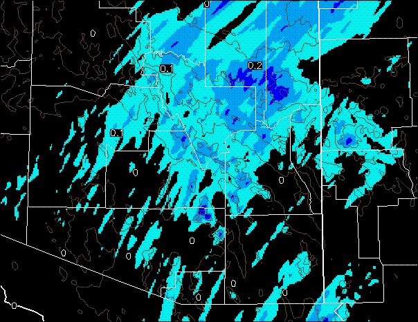
I have been working on other things today and have just gotten around to taking a look at the WRF morning forecasts from Atmo. The models are sending somewhat conflicting messages today (internally - but not between the two variants). Both the NAM and GFS versions forecast little precipitation in eastern Pima County, as the rest of the 500 trough swings through from the west coast - exception is at higher elevations in the Catalinas and Rincons. Forecast from the GFS variant is shown above for accumulated precipitation through midnight tonight (Monday, 4 November). However, the forecast sounding for TUS valid at 8 pm this evening (below) appears quite favorable for convection and some rainfall - note that CAPE is more than 700 J/kg and PW is around 3/4 of an inch. So, the forecasts appear more favorable for eastern Pima County than they did on Saturday morning. Will be interesting to see if there is rain in the gauge here by midnight.


Sunday, November 03, 2013

Tropical Storm Sonia Develops


Tropical Storm Sonia has developed over the eastern Pacific (the 18th named storm of the season). Current forecast for Sonia is shown above, from NHC. Tropical storm warnings are in effect for the west coast of Mexico at the southern end of the GoC. An IR image of Sonia is shown below from 5:30 am MST this morning.


Rain Showers!


Light rain showers moved through eastern Pima County around midnight last night. Covereage was considerably better than expected, and 60 ALERT sites (65% coverage) had rainfall during the 12 hours ending at 5 am MST this morning (Sunday, November 3rd). It was wonderful to smell rain and have some humidity this early morning. This was the first rainfall here at the house since September 9th. Regional radar from NCAR RAL (above) shows a band of showers moving across eastern Pima County at midnight.


Amounts, where the showers hit, were generally around 1/10th of an inch, although Mt. Lemmon reported 0.31". Plots from the ALERT network at 5 am for the west (above) and east (below) show that most of metro Tucson had showers.


Saturday, November 02, 2013

Middle-Level Clouds During The Night


The 500 mb closed low west of Baja (top panel is NAM 500 mb analysis for 18 UTC) is forecast to open up, weaken, and move rapidly across Arizona tonight. As it does, there is a brief period of middle-level cloudiness during the night. The morning run of the WRF-NAM at Atmo forecasts some radar echoes across eastern Pima County around midnight (forecast of composite radar echoes valid at midnight is just above). These echoes are mostly aloft, since the forecast of accumulated precipitation through noon on Sunday (below) shows that little rain is forecast to reach the ground. The forecast skew-T for TUS, valid at 2 am MST, is shown at the bottom. The forecast indicates a saturated layer between 700 and 500 mb, but with the lower levels remaining extremely dry.


Early Morning Temps All Over The Place


Early this morning (Saturday, November 2nd) temperatures in the metro Tucson area have been all over the place. The time series from Atmo (above) shows that temperatures there have been bouncing up and down between 50 and 58F since 3 am MST. The MesoWest surface plot (below) for 6 am shows that strongest east winds stayed at higher elevations (although DM has had east-southeast winds of 15 to 20 mph). Temperatures ranged from 36F at Mescal (just east of Vail) to 65F at Sahuarita. Lows through 5 am were: here at house 37F, Sasabe 37F, Empire 40F, TUS 47F, Atmo 50F, and DM 55F. All of this illustrating how variable the temperatures can be across Tucson when the winds are sporadic and continue through the night at some spots but not others.


Friday, November 01, 2013

Updated WRF Forecast For Tonight


The morning forecast runs for the WRF variants were quite similar to the early runs discussed in post below. Shown above is the 12 UTC WRF-GFS forecast of winds valid at 5 am tomorrow morning, indicating strong east-southeast winds along the I-10 corridor. Below is the forecast of 2-m temperatures valid at the same time. This could be one of those situations when the low at the airport is very much warmer than that here at the house - depends upon when the winds break through into the Rillito wash.


Below is the current NWS hourly, grid point forecast valid at TUS from 3 pm this afternoon through 2 pm tomorrow afternoon. Note that the difference between Atmo's WRF model forecast for the airport versus NWS is almost 20F.


Last Cold Morning Of Week?

It was another cold morning across much of southeast Arizo, with lows at many spots near or below freezing for the second straight morning. Here at the house the low hit 30F this morning, making it the first low this Fall below freezing. Empire RAWS hit 29F yesterday and Sasabe RAWS had lows of 31F yesterday and today. What about tomorrow? - will address this below.


But first, looking south, there is another TD this morning - number 18 for the East Pacfic this season. Forecast from NHC is above, indicating it will become another tropical storm (Sonia). The 1230 UTC IR satellite image below shows cloud mass with the TD near 15N 110W, but with deep convection extending northward to near the mouth of the GoC. Moisture from the subtropics increases over the weekend, but model-forecasted rainfall just brushes the southeast corner of Arizona. More heavy rains possible for central Mexico and perhaps again into south Texas.


This morning a front is moving southward along the Front Range of New Mexico, as a 500 mb short wave crosses eastern Colorado and New Mexico. This front will back into southeastern Arizona tonight bringing strong, easterly, downslope winds with it. Below is early WRF-NAM, from Atmo, forecast of 10-meter winds valid at 2 am tomorrow morning (Saturday, November 2nd). The strong winds result in much warmer temperatures for tomorrow and Sunday mornings - lows 20 to 25F higher than past two days. So assuming that the WRF verifies, this is indeed the last cold morning of the current, short cold spell.


Thursday, October 31, 2013

Cold Halloween Morning


Quite a biting cold along the Rillito this morning with frosty breath (need to add that cold here in Sonoran Desert is all relative compared to places like Fargo North Decoder). Had 32F on one thermometer here at house and 34F on other, so will record low as 33F. Was undoubtedly below freezing down along the wash. October 2013 ends as an unusually cool month here at the house. There were 12 mornings with low temperatures in the 30s - today being the coldest of the month. In comparison October 2012 had only two such mornings. As for rainfall there was absolutely none this year, while 2012 had 0.02".


Wednesday, October 30, 2013

Fatal Crash On I-10 In Dust


The desert along portions of I-10 between Tucson and Phoenix resembles scenes from Mad Max, due to nearly a century of over-grazing and commercial agriculture during recent decades. This corridor is prone to serious dust storms and multiple vehicle crashes. Yesterday afternoon blowing dust south of Casa Grande resulted in a pileup involving about 20 vehicles, many of them 16-wheelers (see above). There were three fatalities and many injuries, leaving I-10 westbound closed for more than five hours.


The 5 pm webcam view of the Catalinas, from the Computer Science Building, at 5 pm MST yesterday (above) appears to have captured some of the dust storm in the distance - at lower, left corner of the image. There were also thunderstorms with some lightning strikes along the Mogollon Rim (below) yesterday afternoon as the 500 mb short wave slowly moved eastward across the state.


Tuesday, October 29, 2013

Surface Observations At TUS Yesterday


Yesterday afternoon turned cloudy and very dreary, as thick cirrus streamed in from the west-southwest. There was a bit of dust in the air also, as the 5 pm MST view of the Catalinas (above) indicates. However, the surface observations from TUS (below) indicate that the day was characterized by clear (CLR) skies. The reason is that the automated "observing" system (ASOS) used by the NWS only detects clouds below 12,000 ft AGL. Thus, the discrepancy between actual sky conditions versus the ASOS "observed" sky conditions. At larger airports, as per Phoenix's Sky Harbor, the ASOS observations are augmented through the addition of human-observed cloud-cover information.


The visible satellite image (above, from 3:45 pm MST) shows the thick cirrus streaming east-northeastward from northern Baja. Strong flow over the mountain ridge-line of Baja induced an orographic enhancement of the cirrus and gave us our dreary afternoon. Direct solar radiation, as measured at Atmo (green curve below) indicates the impact of the cloudiness beginning after 10 am MST, with very low solar radiation values after 2 pm.

At times limited cloud information from the NWS can have impacts beyond the aviation weather system. For example, when air-quality modeling was done to estimate the impacts that the proposed Rosemont copper mine might have, the ASOS surface observations were used from TUS as a surrogate for solar radiation at the project site to the east. The observed sky cover at TUS was used internally within the model to deduce what the solar radiation might have been. Situations like yesterday were probably not handled well by the modeling approach used by consultants to the project. For those interested, more complete technical details are available at:   http://www.squidinkbooks.com/madweather/pdfs/Rosemont-DEIS-Comments-Air-Quality-RAM.pdf


Monday, October 28, 2013

Another Wind Event For Much of Arizona

The strong, 500 mb closed low over western Nevada is forecast by the latest NAM to move slowly east-northeastward and gradually weaken during the next 48-hours. As the system moves across the northern Great Basin today it will produce strong and gusty winds across most of the Southwest.


Here are several forecasts from the early, 06 UTC, WRF-NAM forecast runs at Atmo this morning. Above is forecast of 10-m winds, on the 5.4 km grid, valid at 8 am this morning (Monday, October 28th). Strongest winds at that time were forecast over far northwest Arizona and the southern great Basin. The system is fairly dry and the model forecast of total precipitation through midnight tomorrow night is shown below, again on the 5.4 km grid. Heaviest precipitation from this event forecast to be in western Nevada and the California Sierra Nevada range. Arizona picks up some precipitation, mostly on the Kaibab Plateau and along the Mogollan Rim country.


Here in southern Arizona winds are forecast (above is 10-m winds on the 1.8 km grid valid at 5 pm MST) to be strong during the afternoon today, but not nearly as strong as to the north. There will probably be some local blowing dust. The soil here along the Rillito is powder dry, as it has been most of the summer.