
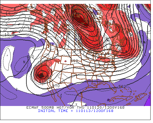

The ECMWF has interesting forecasts at 144 and 168 hours from 12 UTC this morning. The top panel shows the ECMWF surface forecast valid at 1200 UTC on Wednesday the 19th of January 2011. Looks like a play-it-again forecast for the Northeast. The 500 mb ECMWF forecast at 500 mb for 168 hours is shown in the middle panel, which is valid at 1200 UTC next Thursday morning. This model forecasts a cutoff along the southern California coast - this would be the first interesting chance for weather in the far Southwest during 2011 However, the GFS at 168 hours (bottom panel) is quite different, with a weak, low-latitude wave and northwesterly flow over most of the West. So, it will be interesting to watch the two models as their forecasts evolve over the weekend.
No comments:
Post a Comment