
Visible satellite image for 8 am MST (above) depicts less cloud cover this morning, so that more heating is likely to occur in some areas of southeastern Arizona. There is a very weak 500 mb disturbance within the cloud mass over northern Sonora. The NAM analysis this morning seems to have winds at 500 mb a bit too strong wrt the Mexican sounding data. The disturbance may also be oriented more west-to-east than is depicted by the NAM analysis, which hasn't accepted the weak southerly wind observed at Guaymas. Regardless, the heaviest storms will continue to be associated with this feature.
The morning sounding from Tucson (below) is very moist and tropical appearing. CAPE is again somewhat limited due to warmer middle-level temperatures. However, it appears that substantial CAPE will be present over the mountains and these storms may drift toward the southwest, since very weak winds continue aloft. Heavy rains likely to be produced by the storms that form for the third consecutive day.

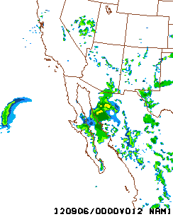
The morning NAM (no earlyWRF-GFS today) forecasts most substantial storms to continue in northern Sonora and along the Borderlands. Below is NAM forecast of radar echoes valid at 5 pm MST this afternoon. Note that the relatvively crude resolution of the NAM produces much weaker radar echoes than does the high-resolution WRF. In the longer-term, it appears that a trough at 500 mb will deepen into the central US, leading to a strong backdoor front into New Mexico and southeastern Arizona by Saturday.
No comments:
Post a Comment