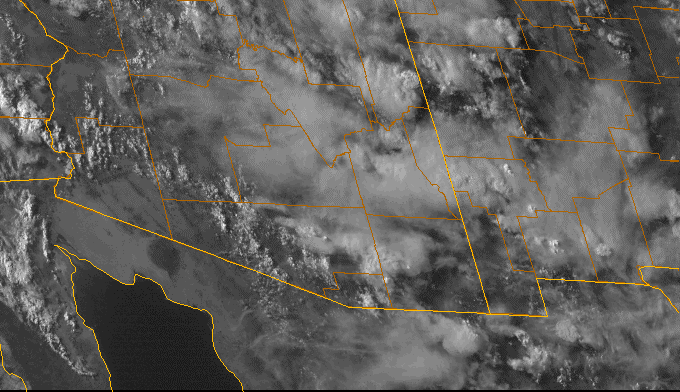
By early afternoon yesterday storms had formed over higher terrain and then filled the skies with anvil debris - above is visible image for 5:30 pm MST. A couple of very weak outflows passed TUS during the afternoon. Which may have led to the sounding structure in low-levels shown below on the 00 UTC (12 Jul 13) skew-T. Note that the surface boundary layer is very shallow and that mixing ratio decreases with height - very much different than the sounding forecasts by the early WRF-GFS - see earlier posts.


Cloud-to-Ground lightning strikes for the 24-hours ending at 5 am this morning are shown above. The intense activity over Cochise County has been produced by a nocturnal MCS. Activity over western Cochise and Pima Counties was confined mostly to the mountains. So, the models did capture the down trend during the afternoon yesterday correctly. Another day here at house with thick afternoon clouds and no rainfall.
Across the ALERT network 27 of 52 sites (52%) reported rain during the past 24-hours, with amounts being mostly quite light. Only two stations had more than 0.25", with max of 1.06" at the Oracle Ranger Station. The nocturnal MCS has produced 1.28" at Chiricahua NM Headquarters; 1.19" at Rucker RAWS; and 1.14" at Douglas. So, Cochise County continues very wet.
No comments:
Post a Comment