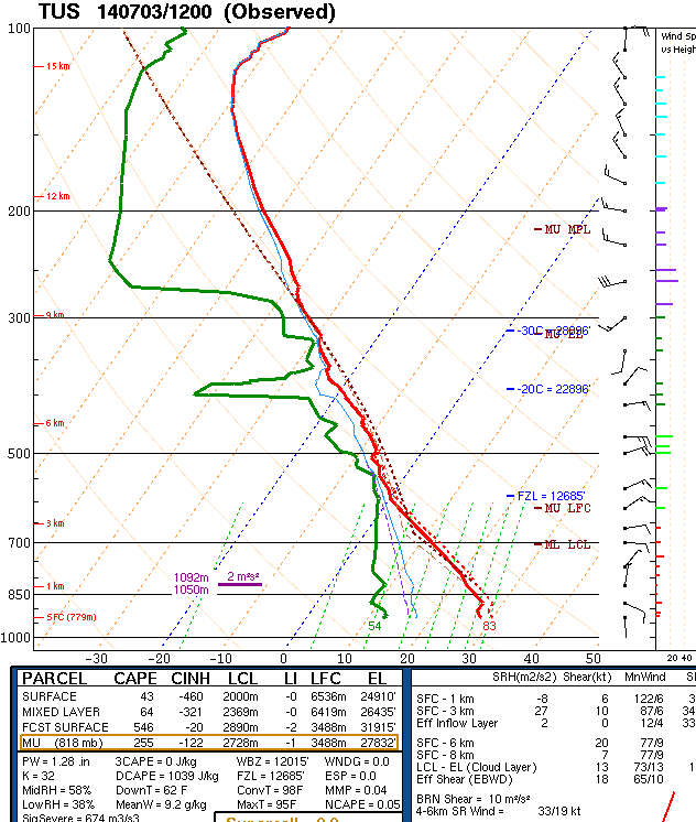
The Tucson morning sounding plot is shown above. The sounding continues to have a deep, relatively dry BL and only a small amount of CAPE. The PW is around an inch and a quarter and middle-level temperatures remain quite cool. There is a decent wind shear profile through the cloud layer, with easterly steering winds and northwesterly winds at anvil levels. The Empalme morning sounding (below) provides quite a contrast with a deep tropical air mass, light winds aloft, and over 2 inches of PW. The push of moisture up the GoC has been reflected by strong winds at Yuma and in the lower Colorado Basin, and PW/Td increasing gradually increasing through the last two days. The CIRA PW analysis for 10 am MST this morning (second below) indicates that PW values are currently near two inches over southwest Arizona.


The 12 UTC run of the WRF_NAM at Atmo this morning forecasts several rounds of convection moving across the meror area today, July 3rd (above is forecast of composite radar echoes valid this evening at 5 pm MST). Total rainfall forecast through midnight tonight is shown below - this forecast indicates considerable better coverage of measurable rainfall this afternoon and evening from the Tucson area westward across Pima County and northward into Maricopa County. The lines of convection produce two distinct and stron outflows in the model forecast of 10-m winds (bottom, valid at 7 pm MST this evening). Note that the second outflow impacts the metro are primarily with westerly, cool winds blowing easterward from the associated mesohigh.
Today I'm just going to watch things evolve and am, of course, hoping for a bit more rain in the gauge.


No comments:
Post a Comment