Thursday, August 25, 2016
Early Fall Large-Scale Pattern Continues
There were thunderstorms over northern and far southeastern Arizona - as the plot of CG flash density for 24-hours ending at 7:30 am MST tis morning (from weather.graphics and Vaisala). Some storms and gusty winds made it out into lower elevations of eastern Maricopa County, bring parts of Phoenix area thunder and gusty winds.
Precipitable water continues holding on at values of an inch to an inch and a half over portions of southern Arizona (CIRA blended PW analysis above is from 6:00 am this morning). Here at Tucson, as per morning sounding below, PW has crept up to just over an inch and there is a bit of CAPE at low elevations. Only winds of significance are above 500 mb.
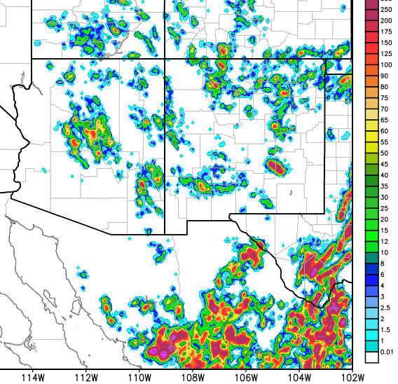
At 500 mb a trough from southern Canada into the Great Basin is having increasing influence over the Southwest and will dominate the large-scale pattern for next few days (chart below is NAM forecast valid at 5:00 pm this afternoon). So depending upon PW and CAPE evolution, there may be a chance for storms in our area on Friday and Saturday from this transition type setting. Both WRF forecast runs from 06 UTC suggest isolated storms over the nearby mountains later today.
If anyone follows the NWS FDs, I suggest the Phoenix discussion this morning:
http://www.wrh.noaa.gov/total_forecast/getprod.php?prod=XXXAFDPSR&wfo=PSR
since it has some interesting content, as opposed to mini-discussion from Tucson.
Subscribe to:
Post Comments (Atom)


No comments:
Post a Comment