
Sunrise color over the Catalinas at about 5:50 am MST this morning.

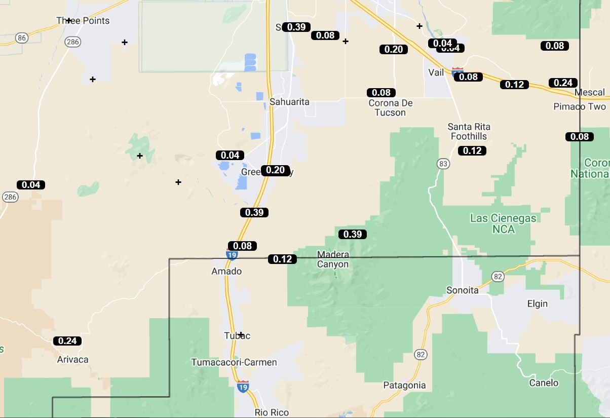
Storms and rainfall were scattered around the metro area during past 24-hours, as per the ALERT maps (above and below) for the 24-hours ending at 7:00 am this morning. Rain fell at spots both in afternoon yesterday and around midnight also. Here at house we were avoided by all storms with no rain in the gauge this morning.
There were some storms in Arizona with severe wind gusts yesterday - these were mostly around the Phoenix region, One site reported a measured gust to 76 mph at Peeples Valley, north of Wickenburg.

The 500 mb pattern remains very chopped up with minimal height gradients and light winds. The 250 mb morning analysis (above) shows the upper-tropospheric anticyclone amplified and shifted north, to be centered about over the Uinta Mountains of Utah.
The TWC/TUS morning sounding (below) remains moist, but with limited CAPE and wind speeds mostly 20 kts or less. When I estimate afternoon conditions using this sounding, I come up with almost no CAPE available this afternoon. However, my forecasts so far this month have not been good, and the models are again more optimistic than I am.


Forecasts here from the 12 UTC WRF-RR runs at Atmo. Forecast of composite radar echoes (above) is valid at 7:00 pm this evening. Precipitation forecast (below) is for rainfall through midnight tonight. Regardless, yet another interesting weather day for us.

No comments:
Post a Comment