
Heavy anvil cloud cover yesterday afternoon at 4:10 pm MST acted to limit storm activity over our region. Plot of detected CG flashes (below - from Atmo and Vaisala) shows minimal thunderstorm activity over far eastern Pima County, Santa Cruz County, and western portions of Cochise County.

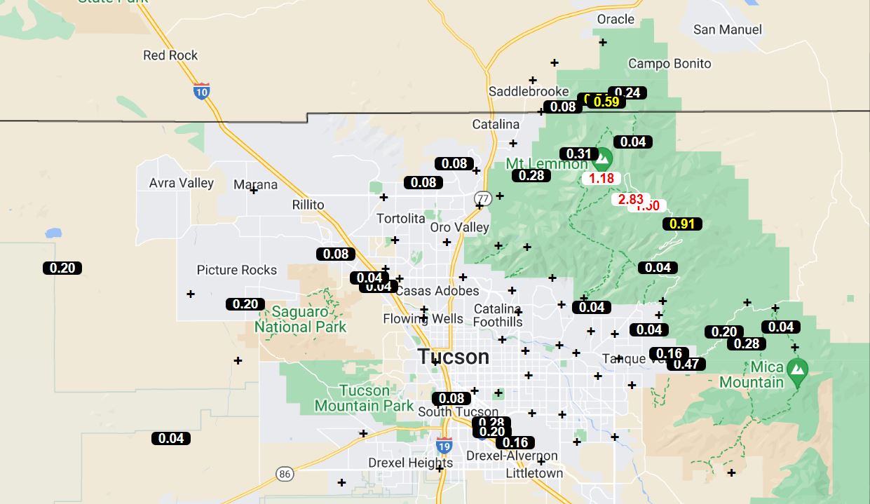
Rainfall reports from the ALERT network (above and below for 24-hours ending at 7:00 am this morning) indicate scattered coverage, with much of main metro area rain-free. There were only 8 sites with half an inch or greater rainfall, and I estimate areal coverage at around 30 percent. Here at house there was a brief shower before midnight last night which produced only 0.01".


The 500 mb pattern remains chaotic, with center of anticyclone circulation about over Goodland, Kansas (the sounding for Denver has been missing for an extended period due to helium shortage at the station). There appears to be a very weak, west to east trough across Arizona. The morning sounding (below) indicates the presence of weak, westerly steering winds. Afternoon activity will likely be driven by outflows, but with anvils again spreading to the north of storms.

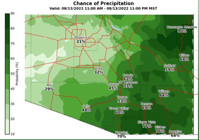
Forecast below is from the WRF-RR run at 12 UTC this morning and shows model forecast of rainfall through midnight tonight. There's a bit of a donut hole over us, and generally reduced storm activity, relative to yesterday, over much of Arizona. Two graphics at bottom show the NWS Forecast Office outlook for today is more aggressive than is the WRF model.

No comments:
Post a Comment