Isolated build-ups over the Catainas at 9:45 am MST this morning.
The NWS has issued a Flash Flood Watch for today - details above. They also have the Tucson area under a Blowing Dust Advisory - as per grahic below.
Current morning forecast from the NWS Office is below, indicating high POPS for the airport today and tomorrow. Only 30 percent POPS on the Fourth of July.
The forecast below is from the 15 UTC run of the WRF-HRRR at Atmo - that model keeps the heavier rainfall mostly south of the Metro area.
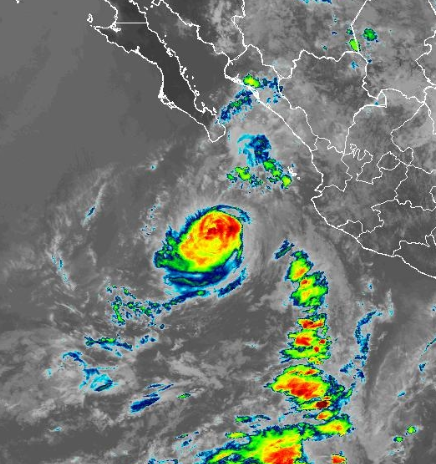
Meanwhile, far to the south, Hurricane Flossie is weakening as it turns to the west-northwest over cooler waters. The storm briefly reached Cat 3 strength (96 to 112 kt/111 to 129 mph) during the early morning hours today. The storm has helped push moist air northward into southern Arizona, contributing to the high chances for rain here today and tomorrow.


No comments:
Post a Comment