Some pre-dawn color this morning looking toward Redington Pass at 5:45 am MST. Down at bottom is view looking the same direction, showing a bright, partial rainbow at 6:40 pm yesterday.
Plot of detected CG flashes (for 24-hours ending at 0803 UTC - 0103 am - from Atmo) shows abundant lightning across eastern Pima County. There was frequent thunder here but only a light, late afternoon, shower. Plot of ALERT Network data (below - for 24-hours ending at 7:00 am this morning) indicates mostly light amounts of rainfall. Atmo reported 0.27"; we had 0.04"; TUS had 0.01" and DM reported thunder with gusts to 36 mph but only a Trace of rain. Note the heavy amounts around and south of Vail.
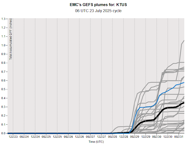
The 06 UTC plumes for QPF at the airport (above) indicate a long dry period into early next week. The plumes for temperature (below) indicate warming temperatures, until early next week. The GEFS POPs (second below) indicate 50 to 60 percent chances for showers early next week, toward the end of July.


No comments:
Post a Comment