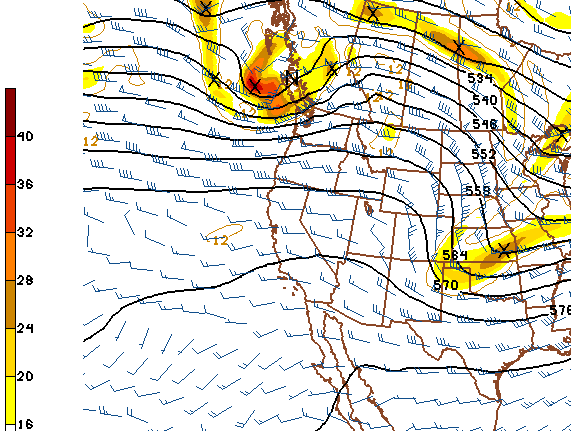


My subjective assessment is that the ECMWF was clearly the better forecast - especially wrt 500 mb heights and vorticity fields across the western US (compare the heights at 558 m for example). The ECMWF captured the strong ridging along the Pacific Coast quite well. The GFS did forecast the pattern over the central US better than did the ECMWF.
It appears that we get some winds and cooling here in southeast Arizona, as this system continues to dig and swings by to the northeast. However, the system threatens to bring blizzard conditions to the High Plains tomorrow afternoon and Friday, as it develops a particularly good inflow of very moist air from the Gulf of Mexico. The big question as far as impacts on people, transportation, and economics is: How much snow will fly between Colorado Springs and Ft. Collins?
No comments:
Post a Comment