
Mike Crimmins (Univ. of Arizona - Dept. of Soil, Water, & Environmental Science) has developed a very useful web site for examining rainfall at a number of sites in Arizona and New Mexico. This information is at:
http://cals.arizona.edu/climate/misc/monsoon/monsoon_summaries.html
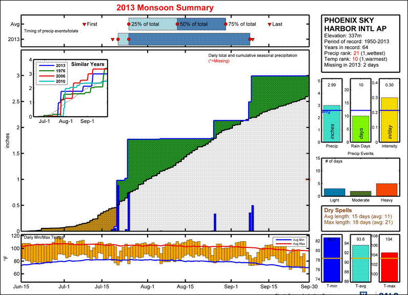
The perspective is Regional, but the data are presented in fine detail - as compared to say the fairly crude map presented in this morning's (Sunday, October 6th) Tucson newspaper. I've extracted the plots for summer 2013 at Phoenix, Tucson (above two), Douglas, and El Paso (two below). These data are from the NWS observations at the airports in these cities. Phoenix ended up a bit above normal, while Tucson had a very down summer storm season (as I've been moaning about since the end of July). Douglas and El Paso were very wet this summer. But it is interesting that Douglas was extremely wet in July; whereas, El Paso picked up its heaviest rains during the second half of September during a significant transition event (this episode also produced devastating floods across portions of New Mexico and Colorado).
At the url given above, Mike has provided a guide to the site and the data plots - enjoy.


No comments:
Post a Comment