View toward the Rincons at 6:15 am MST this morning.
The morning upper-air sounding from TWC/TUS (above) shows a very deep, well-mixed, residual boundary layer (BL) that has a small amount of CAPE above 600 mb. The radar image from 9:15 am (below) shows a small area of storm echoes generally along I-19 toward Nogales - note that these data are from the 4rth tilt (3.1 degrees) because of the large area of terrain blockage that occurs southwest of the radar. Second below shows detected CG flashes (from Atmo and Vaisala) through 1613 UTC.
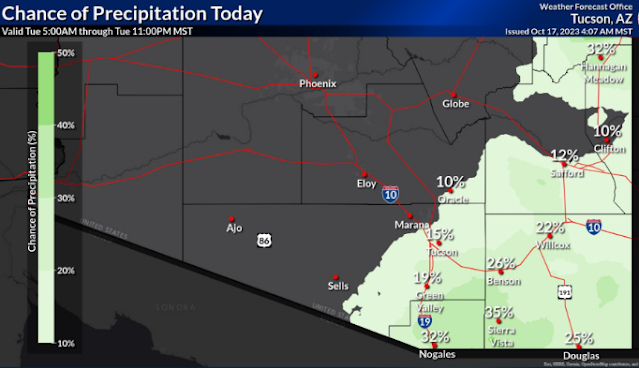
Forecast above is from the 12 UTC WRF-HRRR and shows rainfall through 6:pm this evening - all the rainfall in our area is over by this time in the WRF forecasts. Current POPs from the NWS (below) are valid through midnight tonight.


No comments:
Post a Comment