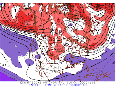
Shown above are the ECMWF forecast at 500 mb for 168-hours from 0000 UTC last evening (valid at 0000 UTC on 31 March - top), and the same forecast from the GFS model (bottom). Both forecasts are from the operational versions of the models. It is of interest that the GFS is deeper than the ECMWF for this forecast cycle - a reverse of the usual situation. The forecasted vorticity maximum in the Southwest is considerably further west and south of that forecast by the ECMWF. The upstream ridging over the east Pacific and northwest North America is considerably stronger in the GFS (heights over southwest Canada about 150 to 200 m higher in the GFS forecast), leading to the stronger downstream digging. Several of the GFS ensemble members are even more aggressive, forcasting a deep, 500 mb cutoff over the Southwest at this time. So, something to watch in the next few model runs.
---------------------------------------------------
Edited Friday morning to add: The 144-hour forecast runs of the GFS and ECMWF are now very similar, with the GFS having become quite like the ECMWF, which continues to have the vorticity maximum along the Colorado/New Mexico border as per above.


No comments:
Post a Comment