Thursday, September 22, 2011
Hurricane Hilary
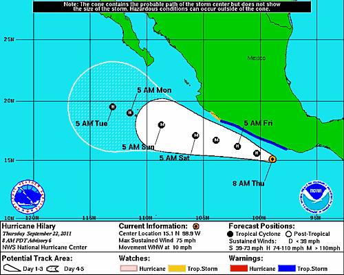
The disturbance mentioned a couple of posts ago is now Hurricane Hilary, which is forecast to become the fourth major hurricane in the eastern Pacific this season. Above is the current forecast for Hilary - which is very similar to the track followed by Hurricane Greg. This track is marginal for initiating a surge of moisture up the GoC. However, there is substantial variance among various model forecasts, so we'll have to keep close watch on Hilary.
The above two images are from 1515 UTC and show the visual and IR depictions of Hilary. Of great interest is the large and intense MCS that is currently west-northwest of Hilary. It is unclear how the two features will interact today.
Subscribe to:
Post Comments (Atom)


No comments:
Post a Comment