Wednesday, March 28, 2012
GFS Has Shifted Toward ECMWF
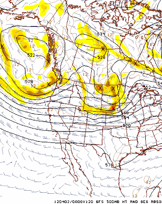
During the past two days the GFS forecasts (above is 168-hour GFS forecast for 00 UTC 2 April 2012) have trended dramatically toward the ECMWF (see previous post). Now the 120-hour forecasts are more similar with the GFS having a large 500 mb cyclone off of western Canada. Forecast heights (GFS at 120-hour below) in northwestern Arizona have increased by approximately 300 m!
The current ECMWF at 120-hours (below) is now slower and a bit deeper over the western U.S. than is the GFS. Model differences would indicate severe thunderstorms further south and more numerous over the Plains on April 2nd, if the ECMWF proves more accurate
Subscribe to:
Post Comments (Atom)


No comments:
Post a Comment