
There were some heavy storms drifting around southeast Arizona yesterday, as per CG activity ending at midnight (above) and webcam image of a storm on north side of Catalinas a bit before 5 pm MST (below).


The heavily raining storms tended to stay at higher elevations. The ALERT network plot for the Catalinas sector (above for 24-hours ending at 7 am this morning) shows that the storm pictured above dropped over 2.5 inches of rain at the station on Oracle Ridge. Heavy storms also hit on Redington Pass as per sector below.
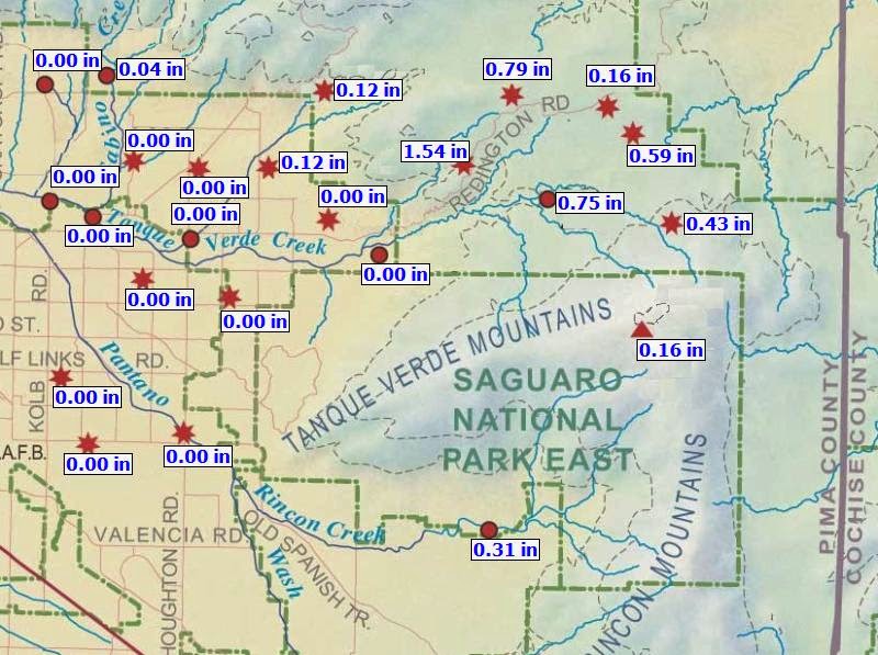

The storms on Redington Pass resulted a flow in the Rillito Wash of over 1000 cfs during the night, as recorded by the USGS gauge at Rillito and Dodge (above). A flow of this size fills the wash about 2/3rds to 1/2 full.
Finally, rainfall reports from MesoWest (below for 24-hours ending at 7 am) show well that heavy storms stuck to the mountains - note that there's a report of over 3 inches from a station in the Whetstone Mountains!

No comments:
Post a Comment