
A bit of pre-sunrise color this morning looking toward Redington Pass at 6:15 am MST.

The 500 mb analysis for the continental US (above) shows the trough that will affect us today and tomorrow currently stretching, north to south, across Nevada and far southern California. The current upper-air sounding from TUS/TWC (below) continues to show very strong westerly winds aloft. However, the sounding is currently very stable and dry - no CAPE and less than a quarter of inch of precipitable water. A special noon sounding could prove very useful today.


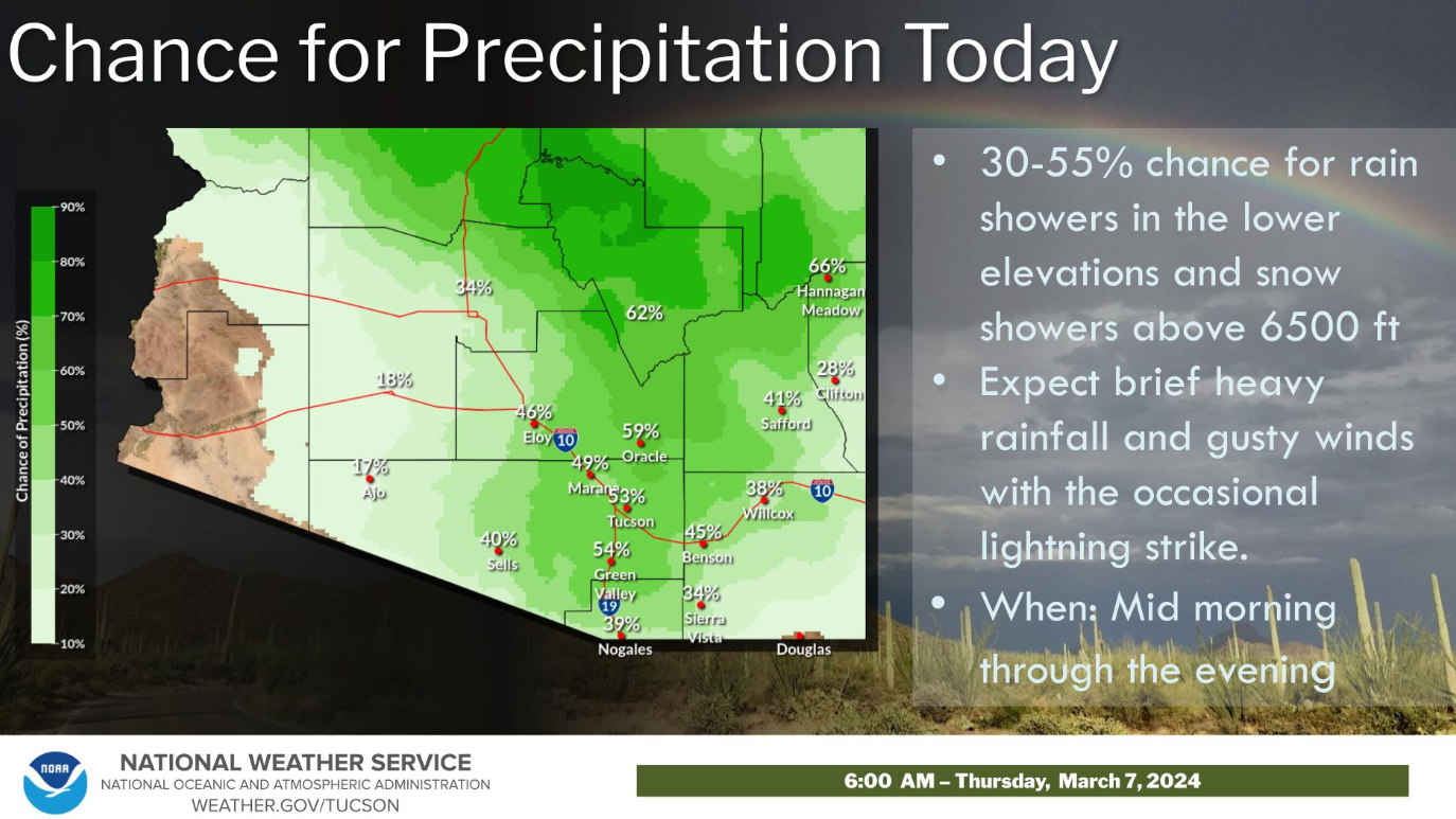
Forecast above shows total precipitation forecast by the 09 UTC WRF-HRRR at Atmo with accumulated rain and high elevation snow across all of eastern Pima County. Current morning forecast graphic/statement from the NWS Forecast Office is shown below.
No comments:
Post a Comment