
Snowy morning up in Summerhaven - view above is from 9:50 am MST.

ALERT plots (above and below) show rain amounts across the network for 24-hour period ending at 6:00 am this morning. Note that rain event occurred mostly from 3 to 5 am, early this morning. Here the house we had 0.25", as did Atmo; the airport reported 0.30" and DM had 0.36". Plot of detected CG flashes (second below - from Atmo and Vaisala) is for 24-hours ending at 1703 UTC this morning. There were thunderstorms in Pima County but they mostly avoided the metro area. Note that the airport did record a wind gust to 45 mph at 3:53 am.


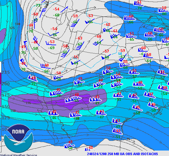
Plot of 250 mb observations (above) shows that there is a very strong jet across northern Mexico and also that the trough axis is still to the west of Arizona. The current NWS morning forecast for the airport (below) continues with 60 POPs for tonight, as the trough axis passes by.

No comments:
Post a Comment