Thursday, July 23, 2015
Sunrise Showers
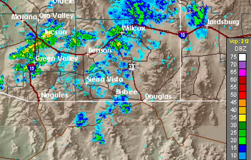
A line of light showers is moving slowly northeastward across the Tucson metro area this early morning. The radar composite chart above is from 5:35 am MST and view of Catalinas at 5:49 am (below) shows the leading edge of clouds with the shower band.
The PW has continued to climb through the night and values are now about the highest they've been in past five days - time series of GPS-estimated PW on campus above indicates values now just over 1.80 inches. There were light showers over the metro area yesterday afternoon but the thunderstorms stayed locked onto higher terrain where they formed. Here at house we had a brief shower, no lightning or thunder, and I found 0.02" in the gauge. This brings the July total here to only 0.22" - one of the driest Julys to date, since I set up the gauge here. Across the ALERT network only 8 sites had rainfall yesterday, also slight amounts except at Florida Canyon where a thunderstorm dumped a quick 0.83".
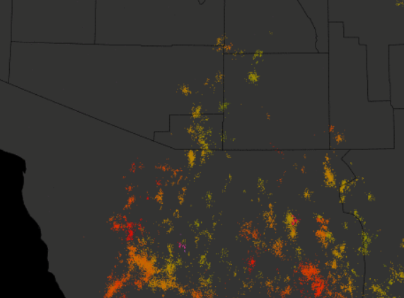
The skewT plot (from Univ. of Wyoming) for the TWC sounding at 00 UTC yesterday afternoon is shown above. There was only a sliver of CAPE in mid-levels to support the showers. Winds below 400 mb remained light and variable, helping to account for the nearly stationary storms. The plot of detected CG flashes for yesterday through midnight (below from Vaisala/Atmo) shows small circular clusters of lightning with the storms in eastern Pima County.
Subscribe to:
Post Comments (Atom)


No comments:
Post a Comment