


As low-level moisture pushes in from the east tomorrow (helped by the tropical disturbance in the western Gulf of Mexico - now Tropical Storm Alberto) winds become gusty. Current wind gust graphic for tomorrow from the NWS shown above. Current 06 UTC forecast for winds tomorrow from the WRF-GFS run at Atmo (below - valid at 10 pm) indicates even more extensive strong winds over southeastern Arizona.


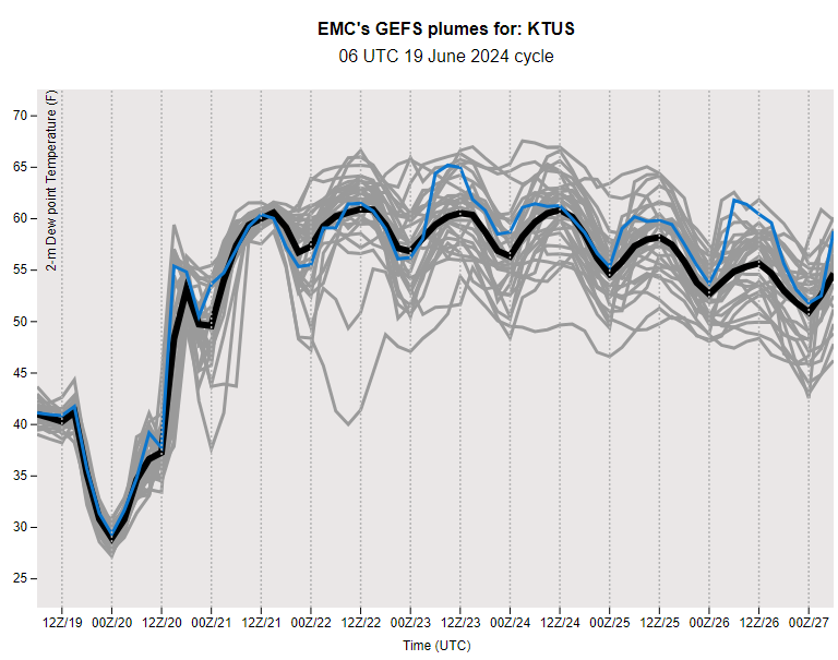
Plumes for surface Td (above from the 06 UTC GEFS runs) indicate a big jump tomorrow, with averages holding 55 to 60 F for rest of the week. The 06 UTC WRF-GFS for PW shown below is valid at 0100 UTC on the 22nd (Saturday). Note that high moisture has also moved northward into southern Arizona from the Gulf of California.


Forecast from the 06 UTC run of the WRF-GFS above is for total rainfall through 11 PM on the 23rd of June. The forecast from the GFS for total precipitation through July 3rd at 06 UTC indicates that the summer monsoon has become well-established!

No comments:
Post a Comment