
Very active thunderstorm day yesterday, as indicated by the CG flashes plot above (from Vaisala for 24-hours ending at 12:30 am MST this morning). The event proved to be widespread by the time it was all over, with only 8 stations across the ALERT network not recording measurable precipitation (0.11" here at house but with about 4 different thunderstorms occurring during the day and evening). Heaviest rains were over the Catalinas and ALERT sector plot below shows rainfall for the 36-hours ending at 6:00 am this morning. The rain/no rain line was more or less east to west a bit south of Green Valley, and the stations with no rain in ALERT network were the most southerly and southwesterly sites.

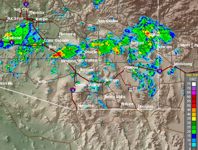


The three composite radar charts above are for approximately 3, 6, and 9 pm yesterday afternoon (from top to bottom). As if it were summer, there were a number of outflow boundaries that interacted with the larger setting. At the airport the dewpoint had fallen to 35 F by 5:00 pm MST, with west to southwest winds. But an outflow from the north passed at 06:20 pm, bringing cooler and more moist air south across the metro area. There appeared to be several convergence zones over eastern Pima County during the evening. The 00 UTC TWC sounding (below) still had CAPE and PW of 17 mm. The strong intrusion of dry air across all of Pima County forecast by the WRF-NAM yesterday did not get as far north as the model forecast (although the no storm line on the CG plot above is very distinct, it was several 10s of km south of what the model forecast).
All-in-all, quite an exciting start for May.

No comments:
Post a Comment