Tuesday, April 26, 2016
Dirty Air Locally - Severe Storms Central U.S.
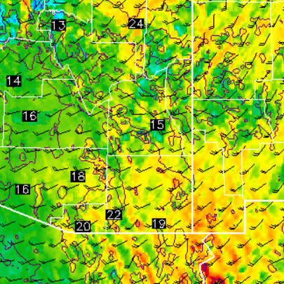
Considerable dust hanging in the air this morning with the Rincons just barely visible from here and Santa Ritas totally obscured. Early morning view of the Catalinas from campus is shown above. Hopefully cleaner air will blow in from west and northwest later today. Winds continue to be main weather as April comes to an end. The WRF runs at Atmo from 06 UTC last night indicate some showers with next system but from the Catalinas north and northeastward. The WRF-GFS forecast of 10-m winds (below valid at 2:00 pm MST) indicates another strong wind day for Thursday.
Meanwhile, an early morning MCS is moving across Missouri and Iowa (above is 1415 UTC IR image and below is 1435 UTC regional radar - base scan from NCAR RAL). This system produced severe winds and hail in the Kansas City area early this morning. Note the small, cold blip near Oklahoma City - severe thunderstorms are already developing in that area also - looks to be a very active storm day as morning upper-air soundings over the southern and central Plains are very unstable. The current outlook from SPC is shown at the bottom.
Subscribe to:
Post Comments (Atom)


No comments:
Post a Comment