
Atmosphere over southeastern Arizona dried considerably during the day yesterday (PW was at 0.75" at 12 UTC but had fallen to 0.39" by 00 UTC) resulting in only isolated moderate buildups over higher elevations (as per 6:00 pm view of the Catalinas above). There were some puny Cbs around eastern Pima County, but most substantial thunderstorm activity was far to north and northeast. Below is 24-hour precipitation through 6:00 am this morning (from MesoWest), showing very little happening yesterday.

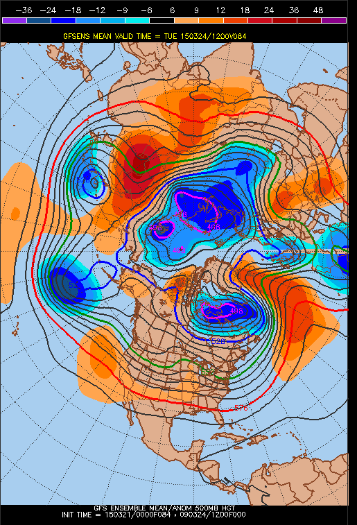
For the coming week (as per the GFS ensemble forecasts' average 500 mb heights), we'll start with zonal flow, with stronger flow far to our north (top, valid at 12 UTC on the 24th). But by the end of week the GFS forecasts a strong re-building of the western U.S. ridge (below valid at 00 UTC on the 28th). Flow does remain weak and chopped up over Arizona and northwestern Mexico, so the most unusual warmth will be over Utah and northward. We are heading rapidly toward our dry and hot months of April through June, and so time is running out for a final, significant rain event for southern Arizona.

No comments:
Post a Comment