Heavy clouds over the Catalina this morning at 7:30 am MST.
Much increased storm activity over Pima County yesterday, as per plot of detected CG flashes (from Atmo and Vaisala) through 0803 UTC this early mroning. There's a bit of a donut hole centered on the Catalinas and I didn't hear any thunder hear. A large MCS developed over Sonora and moved all the way into Southern California during the early morning hourse (IR image below from 0418 UTC).
Alert data for 24-hours ending at 07:00 am (above) shows scattered light amounts across the network.
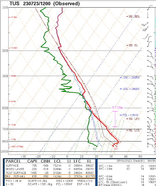
At 500 mb this morning (above) the anticyclone is quite pronounced and centered over southern Utah. The 12 UTC TWC/TUS sounding shows deep easterly flow, little low-level moisture, and at most a sliver of CAPE.
The 12 UTC WRF-RR forecast for precipitation through noon tomorrow (above) forevasts only some light showers in parts of the metro. The morning forecast from NWS (below) was mush more agressive, with fairly high POPs through Tuesday night. However, I notice that a morning update has substantiall reduced the POPs - check their webpage for details


No comments:
Post a Comment