Another beautiful, pre-sunrise sky at 5:30 am MST this morning. Low temperature was again in 80s - fourth morning in a row.
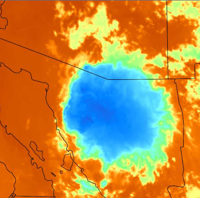
Plot from MesoWest network (above - through 7:00 am this morning) shows only a couple of light sprinkles occurred in the metro area yesterday. Plot of detected CG flashes (from Atmo and Vaisala - below) shows thunderstorms stayed mostly south of eastern Pima County and were concentrated in northern Mexico. A large MCS (see IR image from 06 UTC - second below) affected much of northern Sonora.
The airport reported gusts from the south, genertated by the MCS, of 31 and 32 mph from 10 to 11 pm last night. Nogales reported thunder, light showers, and south gusts to 51 mph around 8:30 pm.
This morning's sound from TWC/TUS (above) is even more moist below 400 mb than was yesterdays. However, there is again limited CAPE, and the nasty inversion at 400 mb remains in place.
The morning forecast from the NWS Forecast Office (above) indicates fairly high chances for showers at the airport through Wednesday night. However, the WRF forecasts from Atmo remain quite dry. Forecast shown below is from the 12 UTC WRF-RR run this morning and indicates almost no rainfall across all of Pima County. Will be interesting to see which forecast is more accurate.


No comments:
Post a Comment