
Large thunderstorm over the eastern Catalinas at 5:15 pm MST yesterday afternoon.

Heavy thunderstorms moved across much of the metro area during the evening yesterday - detected CG flashes (above, from Atmo and Vaisala) for 24 hours ending at 0733 UTC early this morning. Here at the house we had thunder, gusts estimated 50 to 60 mph and 0.16" of rain. Power went out about 6:30 pm and didn't come back until after 5:00 am this morning.
The airport reported thunder, gusts 64 mph and a Trace; DM had thunder with gusts to 58 mph with rainfall details missing; and Atmo reported gusts to 57 mph and 0.31" of rain.

ALERT reports through 7:00 am this morning (above and below) show widespread rain over the northeastern portion of the network. Some amounts ranged from a half to over an inch.


The morning 500 mb analysis (above from NCAR RAP) shows the anticyclone centered over southern Colorado this morning. Moist, easterly to southeasterly flow prevails from southern New Mexico across much of Arizona. An inverted trough is over northeastern Mexico and southeast Texas. This feature, and the upper-level low with it, are moving our direction and will play a significant role in southern Arizona weather next couple of days.
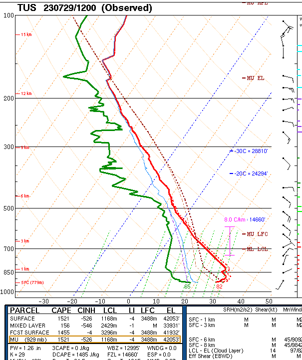
The morning sounding (below from SPC) again does not look particularly favorable for storms today. Winds are generally eaterly at 20 kt or less, and deep-layer CAPE is quite small. I have been fooled by poor morning soundings several days recently. However, I would not anticipate widespread storms with this sounding, especially given that drier air is lurking just off to the east.

However, the NWS morning forecast indicates very high POPs for today (above), and the 06 UTC WRF-GFS forecasts widespread rains across much of Pima County (below). Time will tell.

No comments:
Post a Comment