Sunday, August 28, 2011
Widespread Dust Hanging Over Southern Arizona
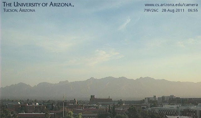
Yesterday thunderstorms from the west metro area out to the Colorado River Basin kicked up many clouds of sand and dust. With sunrise, even Tucson is covered by dirty skies and suspended dust (see above view of the Catalinas from campus this morning). The morning WRF-NAM forecast yesterday proved better than the early WRF-GFS, since it started storms around the Tucson metro, further east than did the other model, and then ran them toward the Colorado River. Yuma had a serious dust storm before midnight with gusts to 58 mph and there were two other wind damage reports between Tucson and Yuma - very desolate country, so it must have been quite ugly out that way. I also saw two wind reports from the southern California mountains - moisture is wrapped up around the back of the middle-level anticyclone across southern California and the Great Basin. The regional radar chart from 0300 UTC last evening (below) shows the area of storms between Tucson and Yuma. This morning there is a very large MCV spinning over western Arizona and it will head north today.
No rain or thunder or wind here at house yesterday - just another very hot and dry day. The eastern Pima County Alert network had 14 gauges with rainfall at 5:30 pm yesterday - about 15% areal coverage mostly in south and west portions of the network. A couple of large cells developed over the airport and moved west across the Tucson Mountains. The gauge out at Brawley Wash and Highway 86 had a local downpour that produced 0.71", which appears to have been far and away the most caught by any of the gauges. After 5:30 pm MST there was no rainfall recorded anywhere in eastern Pima County.
This morning's Tucson sounding is shown above. It is hanging on to a bit more than 1.25" of PW, although the data are a bit too moist wrt GPS PW. The sounding indicates CAPE and has a very good wind profile for organized storms again today. However, the early Atmo run of the WRF-GFS has produced a forecast for a totally down day across southeastern Arizona (the morning WRF-NAM forecast yesterday also indicated the same thing for this afternoon). So, the WRF forecasts bring in serious drying from the east today - the early run today actually forecasts PW here at Tucson to drop below 20 mm this afternoon. It is very dry off to the east and southeast, and all the models (including this morning's NAM) indicate that drying during the day will shut down even the isolated storms we've been experiencing. Not a good forecast.
Subscribe to:
Post Comments (Atom)


No comments:
Post a Comment