
Yesterday was like a switch had been thrown - Wednesday was a day with isolated storms and rainfall in southeast Arizona, while Thursday saw almost 100% coverage of rain across the entire TUS CWA (see 0100 UTC IR image above), with many heavy rain reports. Only two sites in the eastern Pima County ALERT network did not measure rainfall. A remarkable 19 sites had more than an inch, and 3 sites (plus the Saguaro RAWS gauge) had more than 2 inches. Most of these heavy amounts fell in the Catalinas and their foothills (see earlier post and photo below). Here at the house we ended up with 0.36" from steady light, anvil rains that fell for about 3 hours - there appeared to be several nearby postive CGs between 7:00 and 7:30 pm MST. I watched the radar loops between 5 and 7 pm and observed echo cores moving in almost every direction, as the outflows ran off the higher elevations. Really quite a remarkable event, given the synoptic flow situation. Both the WRF and NAM had forecast a considerable upturn yesterday and certainly got the trend, if not the details, right.With the heavy rains, I expected the Rillito to be flowing at sunrise this morning, but it wasn't. The USGS gauge at Rillito and Dodge (about a mile away) shows that flow reached almost 1500 cfs, with a flash flood kind of spike occurring before midnight (see below).

The Phoenix area apparently got some lightning and thunder and more dust, but little rain. There were several reports of wind damage from Sells northward to the Phoenix area as strong outflows ran west and northwestward. Jack Hales sent a link to a loop from the Kitt Peak webcam looking north - it is quite fascinating to watch - thanks Jack! http://www.youtube.com/watch?v=E9Exs5FiOGc
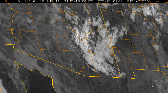
Finally, today there is considerable cloudiness lingering this morning with some showers to the north (see 1400 UTC visible image above). Flow at 500 mb is from the north. The very large, 500 mb anticyclone has three distinct circulation centers this morning - one near Yuma, another over northwest Kansas, and the third over central Texas. Thus, there are several weak troughs wandering around inside the anticyclone. Winds remain weak through much of the trpopsphere. Drier air is over southwestern Arizona, while southeastern Arizona continues to drip with PW. The models forecast a shift of the heaviest activity to the north and northeast today, which appears reasonable given how much CAPE was expended yesterday in the southeast part of state. The early WRF-GFS forecasts some late storms in the Tucson area, but its initialization may have again had problems since it did not catch the morning clouds and showers.
No comments:
Post a Comment