

 Yesterday was characterized by increasing high level moisture, virga, and some sprinkles in the afternoon at some places (not here). The high mountain RAWS stations and Nogales measured very small amounts of rainfall (0.04" and less). However, it made for a nice sunset - see top photo. After 6 pm low-level moisture increased fairly rapidly, with a wind shift to the south and some help from moisture recycling.
------------------------------------------
This morning GPS PWs are 30 to 35 mm at the four stations in southeast Arizona, and very dry elsewhere in state. The PW trend plot (middle graphic) shows this, as well as how very dry last evening's sounding data were (this morning's sounding is about 2 mm too wet wrt GPS data).
------------------------------------------
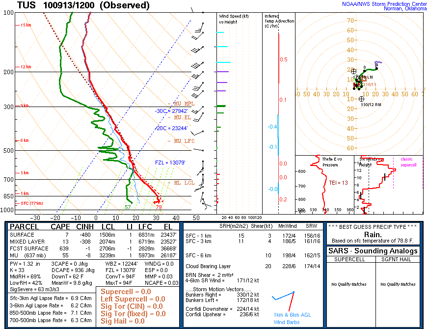
The Tucson sounding this morning (bottom from SPC) indicates little CAPE, but with a small amount possible this afternoon. However, the weak 500 mb shortwave has now passed to the east of Tucson and winds are becoming more westerly in middle levels, while the nice southerly low-level winds of yesterday have become light and variable. It is considerably more unstable to the east, toward El Paso.
------------------------------------------
A look at the Univ. of Arizona/Atmo. 06 UTC run of the WRF-GFS model indicates that the model forecasts only isolated, small showers this afternoon in the far southeast corner of Arizona and northward along the Arizona/New Mexico border into the higher terrain of the White Mountains. So, it looks like the timing of today's slight chance for showers has not quite come together locally. We'll have to hope for a more significant tropical disturbance to come our way, if we're to have some rains of signifcance this month.
No comments:
Post a Comment