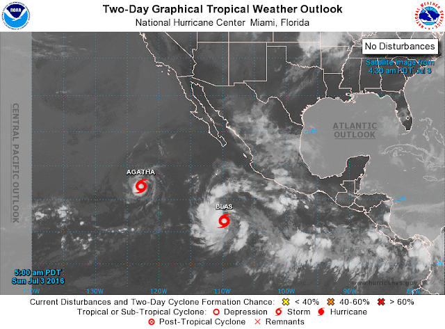
Although it has been a very slow start, the eastern, Tropical Pacific is suddenly quite active. TS Agatha developed yesterday (above) and overnight TS Blas has formed (below).
Both storms are forecast to move west-northwestward, far from land. The forecast above for Blas, indicates that NHC expects it to become a significant hurricane.
Mike Leuthold sent along the image below, which he grabbed from a tweet by Ryan Maue. This image shows a forecast of IR cloud-top temperatures from the ECMWF - it is valid at 06 UTC next Sunday, July 10th. It is quite an amazing forecast - will try to remember to return in a week to see how it worked out.


No comments:
Post a Comment